 |
Coastal Vulnerability Assessment of National Park of American Samoa to Sea-Level Rise
USGS Open-File Report 2005-1055
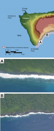
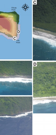
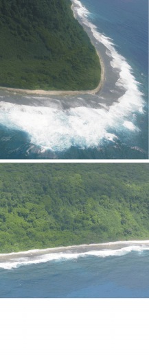
Figure 6. Photographs of geomorphologic features on Ta'u in National Park of American Samoa. The map at the top left is showing the locations of photos A - D. A) This photo shows the transition from low vulnerability cliff (left) to moderate vulnerability alluvium coast (right) just north of Si'ufa'aelele Point. The coral reef becomes more prominent along the moderately ranked section of shoreline. B) Photograph of low vulnerability cliffs in an area lacking a fringing coral reef. C) The beach at Tufu Point is ranked as high vulnerability because of the presence of beach rock. D) A high vulnerability beach along the east side of Ta'u. | ||
 |
 |
 |
 [an error occurred while processing this directive]