
Coastal Vulnerability Assessment of War in the Pacific National Historical Park to Sea-Level Rise
USGS Open-File Report 2005-1056
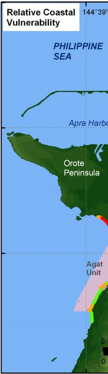
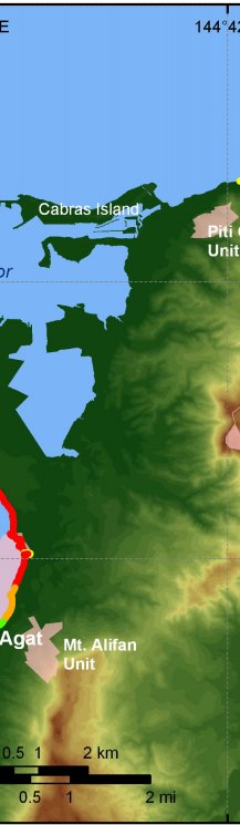
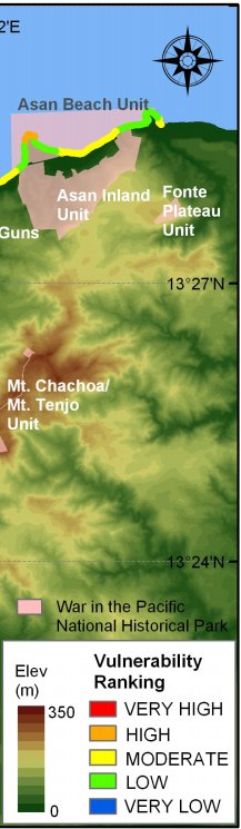
Figure 11. Relative Coastal Vulnerability for War in the Pacific National Historical Park. The colored shoreline represents the relative coastal vulnerability index (CVI) determined from the six variables. The very high vulnerability shoreline is located along the sandy areas of the Agat Unit that have the lowest coastal slopes. The low vulnerability shoreline is located along the rocky parts of the coast with steep coastal slopes. | ||
 |
 |
 |
