
Coastal Vulnerability Assessment of War in the Pacific National Historical Park to Sea-Level Rise
USGS Open-File Report 2005-1056
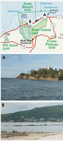
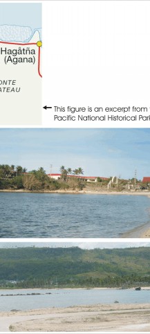
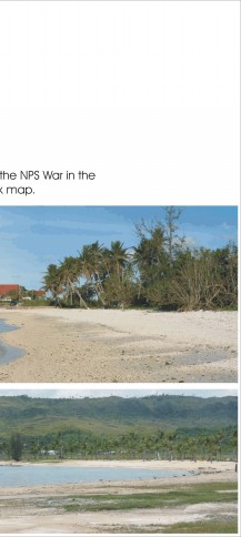
Figure 3. Photos of geomorphic features within the Asan Beach Unit of War in the Pacific National Historical Park. The map at the top shows the locations of photos A and B. | ||
 |
 |
 |
