
Coastal Vulnerability Assessment of War in the Pacific National Historical Park to Sea-Level Rise
USGS Open-File Report 2005-1056
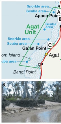
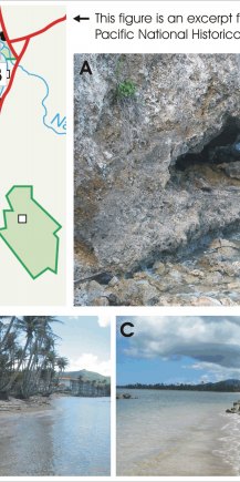
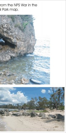
Figure 4. Photos of geomorphic features within the Agat Unit of War in the Pacific National Historical Park. The map at the top left shows the locations of photos A,B and C. | ||
 |
 |
 |
