
Coastal Vulnerability Assessment of War in the Pacific National Historical Park to Sea-Level Rise
USGS Open-File Report 2005-1056
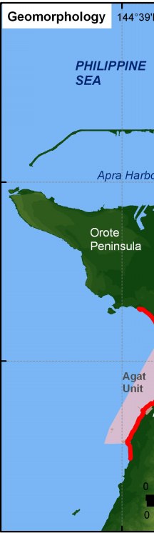
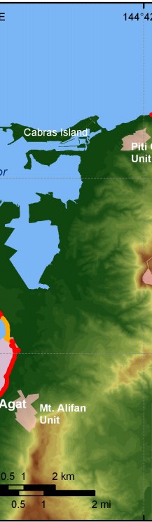
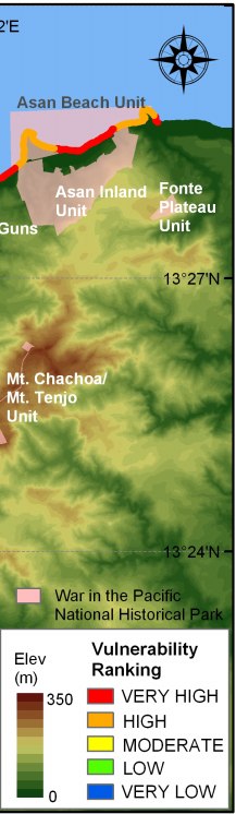
Figure 5. Coastal geomorphology for War in the Pacific National Historical Park. The colored shoreline represents the variations in coastal geomorphology within the park. War in the Pacific NHP consists of several geomorphic types, including high vulnerability rubble to rocky shoreline skirted by fringing reef and very high vulnerability sand beaches with fringing reef. | ||
 |
 |
 |
