
Coastal Vulnerability Assessment of War in the Pacific National Historical Park to Sea-Level Rise
USGS Open-File Report 2005-1056
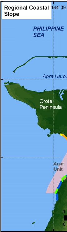
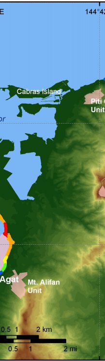
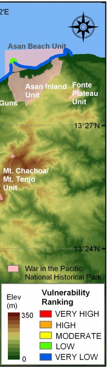
Figure 7. Regional coastal slope for War in the Pacific National Historical Park. The colored shoreline represents the regional slope of the land, 2 km landward and seaward of the shoreline. The Asan Beach Unit is low to very low vulnerability with respect to coastal slope because of the higher elevation upland behind the beach. Parts of the Agat Unit are higher vulnerability because of flat lying areas near the coast. | ||
 |
 |
 |
