
Coastal Vulnerability Assessment of War in the Pacific National Historical Park to Sea-Level Rise
USGS Open-File Report 2005-1056
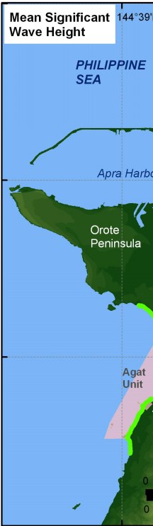
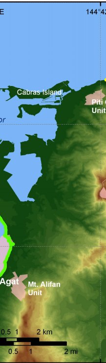
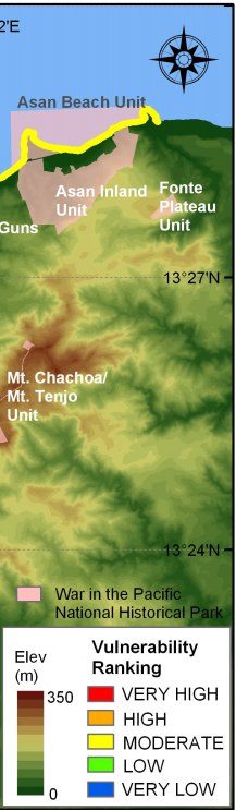
Figure 9. Mean significant wave heights for War in the Pacific National Historical Park based on NDBC data. The colored shoreline represents the mean significant wave heights within the park. The Asan Beach Unit is of moderate vulnerability with respect to wave heights; however, mean significant wave height is low vulnerability within the Agat Unit because this coastline is partially sheltered by the Orote Peninsula. | ||
 |
 |
 |
