
Coastal Vulnerability Assessment of Channel Islands National Park to Sea-Level Rise, USGS Open-File Report 2005-1057
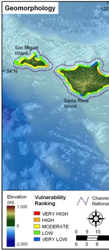
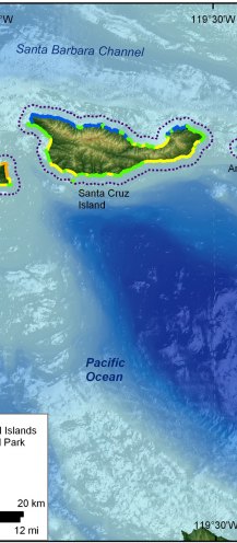
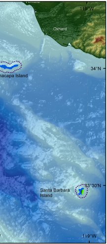
Figure 3. Coastal Geomorphology for Channel Islands National Park. The colored shoreline represents the variations in coastal geomorphology within the park. High vulnerability geomorphology includes gravel and sand beaches not backed by cliffs. Moderate vulnerability geomorphology consists of alluvial fans and sand beaches immediately backed by cliffs. Low vulnerability geomorphology includes medium cliffs and rock platforms, and very low vulnerability areas consist of vertical and high rock cliffs. | ||
 |
 |
 |
