
Coastal Vulnerability Assessment of Channel Islands National Park to Sea-Level Rise, USGS Open-File Report 2005-1057
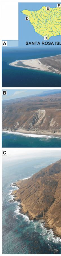
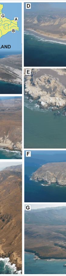
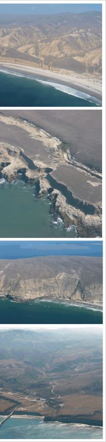
Figure 6. Photos of geomorphologic features on Santa Rosa Island within Channel Islands NP: A) a high vulnerability beach, B) moderate vulnerability beach backed by cliffs, C) low - very low vulnerability cliffs, D) moderate vulnerability beach backed by cliffs near Sandy Point, E) low vulnerability terraced cliffs, F) very low vulnerability cliffs at Carrington Point, and G) moderate - high vulnerability beach at Bechers Bay. | ||
 |
 |
 |
