
Coastal Vulnerability Assessment of Channel Islands National Park to Sea-Level Rise, USGS Open-File Report 2005-1057
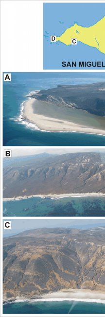
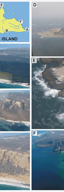
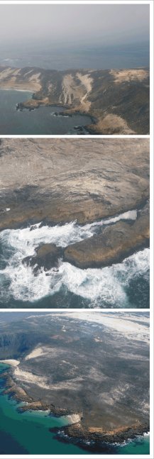
Figure 7. Photos of geomorphologic features on San Miguel Island within Channel Islands NP: A) a high vulnerability beach, B) and C) moderate vulnerability beach backed by cliffs, D) Point Bennet (high vulnerability beaches and low vulnerability rock platforms), E) Harris Point (low vulnerability), and F) low vulnerability cliffs with small interspersed pocket beaches | ||
 |
 |
 |
