
Coastal Vulnerability Assessment of Golden Gate National Recreation Area to Sea-Level Rise
USGS Open-File Report 2005-1058
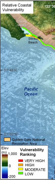
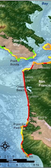
Figure 13. A supplemental CVI was calculated for GGNRA that excluded park lands along Tomales Bay that are managed by Point Reyes National Seashore. This figure was created to further assist park managers, and to display the Coastal Vulnerability ranges, as they would be if Tomales Bay were not a part of the vulnerability assessment. | ||
 |
 |
 |
