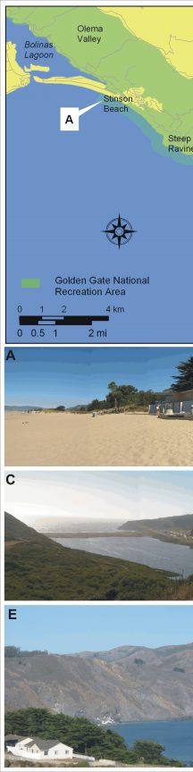
Figure 3. Geomorphologic features within the northern section of GGNRA. The figure at the top left provides an index for photos A-E.
A) Stinson Beach is classified as very high vulnerability.
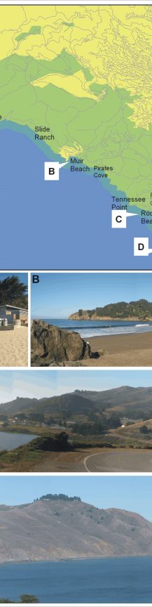
B) Muir beach is classified as moderate vulnerability because it is a large pocket that is mostly backed by cliffs.
C) This photo shows Rodeo Beach near Forth Cronkhite, just north of Point Bonita. This barrier beach and associated lagoon are classified as very high vulnerability.
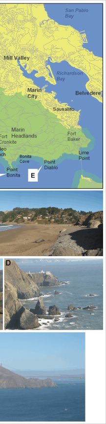
D) The high steep rock cliffs at Point Bonita are classified as very low vulnerability.
E) A view of Point Diablo from Point Bonita, most of this area is classified as low - very low vulnerability depending on cliff height and presence or absence of pocket beaches. The majority of the coastline of GGNRA can be viewed from an oblique aerial photo perspective through the following Web site: http://www.californiacoastline.org/
|