
Coastal Vulnerability Assessment of Golden Gate National Recreation Area to Sea-Level Rise
USGS Open-File Report 2005-1058
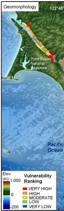
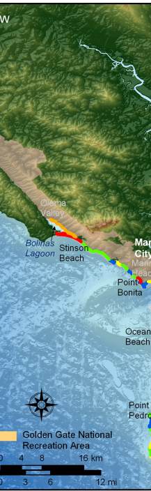
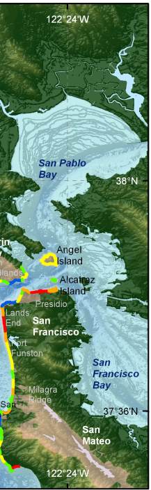
Figure 5. Coastal Geomorphology for GGNRA. The colored shoreline represents the variations in coastal geomorphology within the park. The very high vulnerability geomorphology is mostly low elevation sand beaches and estuary mouths. High vulnerability geomorphology includes gravel and cobble beaches or heavily engineered coastline inside San Francisco Bay. Moderate vulnerability geomorphology consists of alluvial fans and cliffs with sand beaches. Low vulnerability geomorphology includes low to medium cliffs and rock platforms, and very low vulnerability areas consist of mostly high vertical rock cliffs. | ||
 |
 |
 |
