
Coastal Vulnerability Assessment of Golden Gate National Recreation Area to Sea-Level Rise
USGS Open-File Report 2005-1058
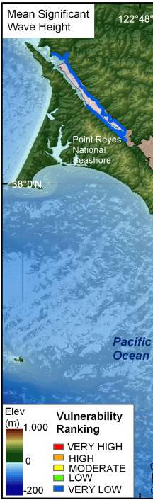
Figure 9. Mean Significant Wave Height for GGNRA. The colored shoreline represents the ranked mean significant wave height within the park. The highest wave heights are located within the southern part of GGNRA where the dominant northwest waves approach uninterrupted. Wave heights are lowest in Tomales Bay and along the Marin headland shore where the coast is sheltered from the dominant wave approach. | ||
 |
 |
 |
