Back to Title Page
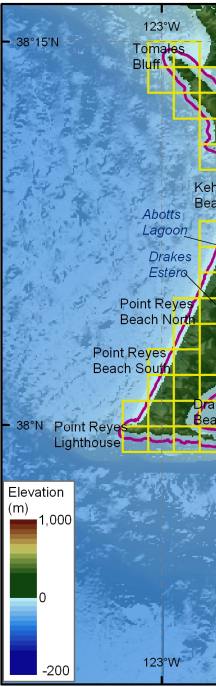
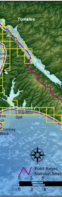
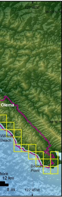
Figure 3. Shoreline grid for Point Reyes National Seashore. Each cell is approximately 1-minute of shoreline and represents a shoreline segment for which each variable is defined.
U.S. Department of Interior / U.S. Geological Survey
USGS Privacy Statement / Disclaimer / Accessibility URL: http://pubsdata.usgs.gov/pubs/of/2005/1059/html/fig3.htm Maintained by Publication Services Modified Saturday, 12-Jan-2013 21:59:46 EST