|
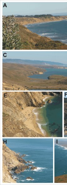
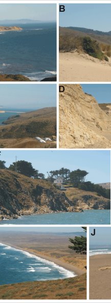
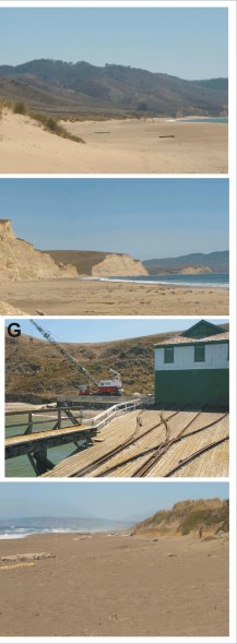
Figure 4. Geomorphologic environments of Point Reyes National Seashore A) The photo was taken looking south toward Duxbury Point from the cliff at Palomarin Beach. The shore here is a sand beach backed by a poorly consolidated terrace deposit (moderate vulnerability). B) The photo was taken looking south from Limantour Beach (high vulnerability) toward Sculptured Beach (moderate vulnerability). C) A view looking south through Creamery Bay in a western arm of Drakes Estero. Limantour Spit (very high vulnerability) can be seen at the mouth of Drakes Estero. D) This photo was taken at Drakes Beach (moderate vulnerability) looking east toward the entrance to Drakes Estero. E) A pocket beach that is a popular haulout for seals and sea lions west of Chimney Rock, this shoreline is classified as low vulnerability because it is mostly rock cliffs, but there are interspersed pocket beaches. F) Low vulnerability rock cliffs adjacent to the G) pocket beach where the Historic Point Reyes Lifeboat Station is located. H) Very low vulnerability rock cliffs surrounding the Point Reyes Lighthouse. I) This is a view from the Lighthouse Visitor's Center looking Northeast toward Great Beach (moderate to high vulnerability). J) Point Reyes Beach South is classified as high vulnerability.
|