 |
|
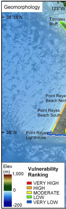
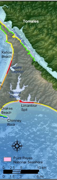
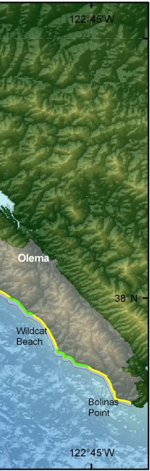
Figure 5. Coastal Geomorphology for Point Reyes National Seashore. The colored shoreline represents the variations in vulnerability associated with coastal geomorphology within the park. The very high vulnerability geomorphology is mostly low elevation sand beaches and estuary mouths. High vulnerability geomorphology includes gravel and cobble beaches or sand beaches backed by low dune cliffs. Moderate vulnerability geomorphology consists of alluvial fans and cliffs with sand beaches. Low vulnerability geomorphology includes medium cliffs with pocket beaches and rock platforms, and very low vulnerability areas consist of mostly high vertical rock cliffs. |
||
 |
 |
 |
