Open-File Report 2005-1162
USGS Open-File Report 2005-1162, Sidescan-Sonar Imagery and Surficial Geologic Interpretation of the Sea Floor off Bridgeport, Connecticut
Title Page | Introduction | Geologic Setting | Data/Processing | Bathymetry | Sidescan | Catalog | Figures | References| Contacts
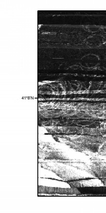 | 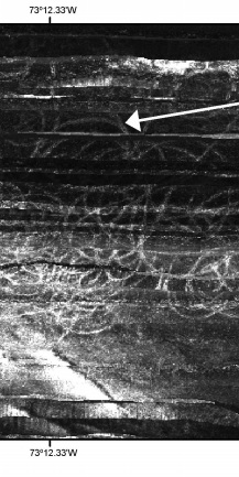 | 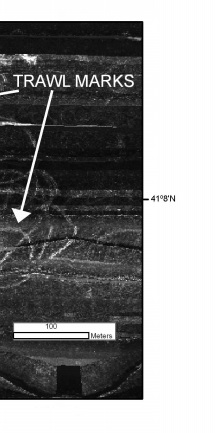 |
Figure 17. Detailed view of trawl marks in the sidescan-sonar mosaic from the Bridgeport, Connecticut, study area. Looped curvilinear trawl marks result from commercial hard-shell clam fishing. Location of this view is shown in figure 10. | ||

![]() U.S. Department of the Interior |
U.S. Geological Survey
U.S. Department of the Interior |
U.S. Geological Survey
URL: http://pubsdata.usgs.gov/pubs/of/2005/1162/html/fig17.html
Page Contact Information: GS Pubs Web Contact
Page Last Modified: Friday, 23-Aug-2024 13:36:50 EDT
