
U.S. Geological Survey
Open-file Report 2005-1170
Nearshore Benthic Habitat GIS for the Channel Islands National Marine Sanctuary and Southern California State Fisheries Reserves Volume II |
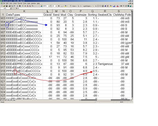 |
| Figure 1. The fields within the data file contain three categories of similar numeric data which may vary both by sample and by field; the differences are in the methods of determination and their underlying reliabilities. The most reliable method gives data that are based on direct measurements of seabed characteristics from lab analyses or probe measurements (coded as "extracted" or "E"). Second in reliability are those values derived from word-based descriptions passed through "fuzzy-set theory" filters (Jenkins, 1997), coded as "parsed" or "P". The least reliable data are those values calculated using variables in the two previous categories and estimated constant values in known models or through empirical relationships, coded as "calculated" or "C." |
http://pubs.usgs.gov/of/2005/1170/images/figure1_usSEABED.html
maintained by Michael Diggles
last modified 2 May 2005 (ng)
USGS Privacy Statement
| Disclaimer
| Feedback
| Accessibility
Department of the Interior U.S. Geological Survey Geologic Division Coastal & Marine Geology Program