
Relative Coastal Change-Potential Assessment of Glacier Bay National Park and Preserve
USGS Open-File Report 2005-1247
|
Relative Coastal Change-Potential Assessment of Glacier Bay National Park and Preserve USGS Open-File Report 2005-1247 |
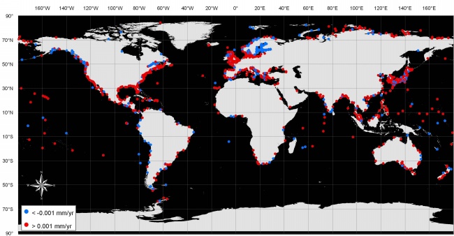
Figure 1. Global distribution of water-level recording stations as reported by the Permanent Service for Mean Sea Level (PSMSL, 2005). Red dots indicate relative increase in sea-level, blue dots indicate a relative decrease in sea-level. Nearly three-quarters of the stations report an increase in sea-level relative to the land surface. | ||
 |
||


![]() U.S. Department of the Interior |
U.S. Geological Survey
U.S. Department of the Interior |
U.S. Geological Survey
URL: http://pubsdata.usgs.gov/pubs/of/2005/1247/html/fig1.html
Page Contact Information: Publication Services
Page Last Modified: 22:06:21 Sat 12 Jan 2013