
Relative Coastal Change-Potential Assessment of Glacier Bay National Park and Preserve
USGS Open-File Report 2005-1247
|
Relative Coastal Change-Potential Assessment of Glacier Bay National Park and Preserve USGS Open-File Report 2005-1247 |
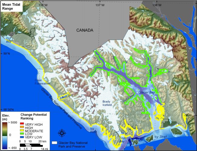
Figure 12. Mean Tidal Range for GBNPP. The colored shoreline represents the ranked mean tidal range for GBNPP. GBNPP is ranked as moderate to low change-potential with respect to tidal range. | ||
 |
||


![]() U.S. Department of the Interior |
U.S. Geological Survey
U.S. Department of the Interior |
U.S. Geological Survey
URL: http://pubsdata.usgs.gov/pubs/of/2005/1247/html/fig12.html
Page Contact Information: Publication Services
Page Last Modified: 22:06:24 Sat 12 Jan 2013