
Relative Coastal Change-Potential Assessment of Glacier Bay National Park and Preserve
USGS Open-File Report 2005-1247
|
Relative Coastal Change-Potential Assessment of Glacier Bay National Park and Preserve USGS Open-File Report 2005-1247 |
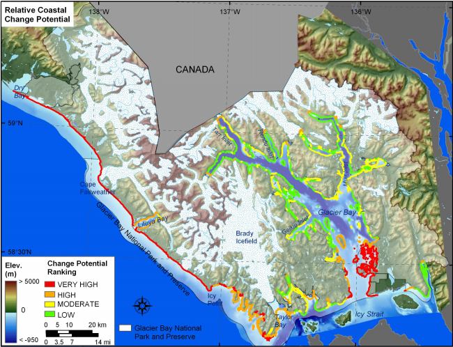
Figure 13. Relative Coastal Change-Potential for GBNPP. The colored shoreline represents the relative coastal change-potential index (CPI) determined from the six variables. The very high change-potential shoreline is located along the outer coast where significant wave heights are high and coastal slopes are low. High change-potential shoreline exists at tidewater glacier termini within the fjords and areas along Bartlett Cove where there are large amounts of unconsolidated outwash material. Moderate change-potential shoreline generally lies within Glacier Bay in areas of alluvium or glacial deposits. The low change-potential shoreline is located along rocky areas and sheltered locations in the fjords | ||
 |
||


![]() U.S. Department of the Interior |
U.S. Geological Survey
U.S. Department of the Interior |
U.S. Geological Survey
URL: http://pubsdata.usgs.gov/pubs/of/2005/1247/html/fig13.html
Page Contact Information: Publication Services
Page Last Modified: 22:06:25 Sat 12 Jan 2013