
Relative Coastal Change-Potential Assessment of Glacier Bay National Park and Preserve
USGS Open-File Report 2005-1247
|
Relative Coastal Change-Potential Assessment of Glacier Bay National Park and Preserve USGS Open-File Report 2005-1247 |
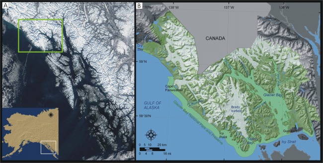
Figure 2. Location of Glacier Bay National Park and Preserve in southeast Alaska. A) MODIS satellite image of the Alexander Archipelago (image from Jacques Descloitres, NASA/GSFC, 2002), the green box is indicating the location of Glacier Bay National Park and Preserve, and B) Glacier Bay National Park and Preserve. A more detailed map is provided by the National Park Service and can be viewed in digital format at http://home.nps.gov/applications/parks/glba/ppMaps/ACF30C1.pdf. | ||
 |
||


![]() U.S. Department of the Interior |
U.S. Geological Survey
U.S. Department of the Interior |
U.S. Geological Survey
URL: http://pubsdata.usgs.gov/pubs/of/2005/1247/html/fig2.html
Page Contact Information: Publication Services
Page Last Modified: 22:06:27 Sat 12 Jan 2013