
Relative Coastal Change-Potential Assessment of Glacier Bay National Park and Preserve
USGS Open-File Report 2005-1247
|
Relative Coastal Change-Potential Assessment of Glacier Bay National Park and Preserve USGS Open-File Report 2005-1247 |
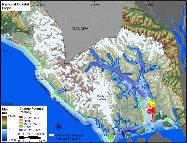
Figure 9. Regional coastal slope for GBNPP. The colored shoreline represents the regional slope of the land, 10 km landward and seaward of the shoreline. Very low change-potential coastal slope areas are where high mountains are adjacent to deep fjords. Coastal slopes become shallower and thus higher change-potential along the outer coast in the Gulf of Alaska and at the entrance to Glacier Bay where there is low elevation outwash material. | ||
 |
||


![]() U.S. Department of the Interior |
U.S. Geological Survey
U.S. Department of the Interior |
U.S. Geological Survey
URL: http://pubsdata.usgs.gov/pubs/of/2005/1247/html/fig9.html
Page Contact Information: Publication Services
Page Last Modified: 22:06:33 Sat 12 Jan 2013