
Coastal Vulnerability Assessment of Kaloko-Honokohau National Historical Park to Sea-Level Rise
USGS Open-File Report 2005-1248
|
Coastal Vulnerability Assessment of Kaloko-Honokohau National Historical Park to Sea-Level Rise USGS Open-File Report 2005-1248 |
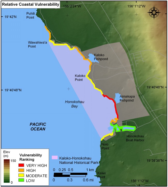
Figure 10. Relative Coastal Vulnerability for Kaloko-Honokohau National Historical Park. The colored shoreline represents the relative coastal vulnerability index (CVI) determined from the six variables. The very high vulnerability shoreline is located along sand beach fronting Aimakapa Fishpond. The low vulnerability shoreline lies within the protected area of Honokohau Harbor. | ||
 |
||


![]() U.S. Department of the Interior |
U.S. Geological Survey
U.S. Department of the Interior |
U.S. Geological Survey
URL: http://pubsdata.usgs.gov/pubs/of/2005/1248/html/fig10.html
Page Contact Information: Publication Services
Page Last Modified: 22:06:51 Sat 12 Jan 2013