
Coastal Vulnerability Assessment of Kaloko-Honokohau National Historical Park to Sea-Level Rise
USGS Open-File Report 2005-1248
|
Coastal Vulnerability Assessment of Kaloko-Honokohau National Historical Park to Sea-Level Rise USGS Open-File Report 2005-1248 |
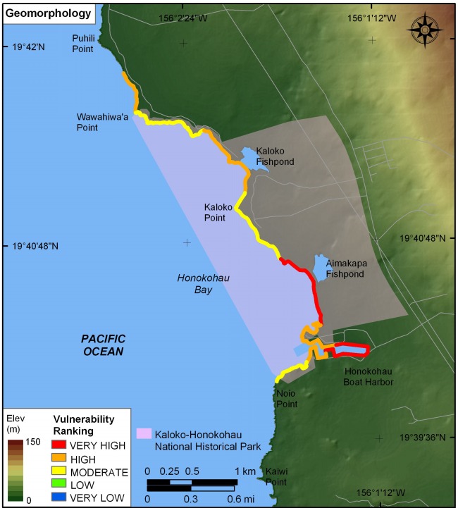
Figure 3. Coastal Geomorphology for Kaloko-Honokohau National Historical Park. The colored shoreline represents the variations in coastal geomorphology within the park. The very high vulnerability geomorphology is mostly sand beaches or mangrove areas. High vulnerability geomorphology includes gravel or coral rubble beaches with basalt platforms outcropping. Moderate vulnerability geomorphology consists of primarily rocky platforms with thin layers of storm deposits. | ||
 |
||


![]() U.S. Department of the Interior |
U.S. Geological Survey
U.S. Department of the Interior |
U.S. Geological Survey
URL: http://pubsdata.usgs.gov/pubs/of/2005/1248/html/fig3.html
Page Contact Information: Publication Services
Page Last Modified: 22:06:53 Sat 12 Jan 2013