
Coastal Vulnerability Assessment of Kaloko-Honokohau National Historical Park to Sea-Level Rise
USGS Open-File Report 2005-1248
|
Coastal Vulnerability Assessment of Kaloko-Honokohau National Historical Park to Sea-Level Rise USGS Open-File Report 2005-1248 |
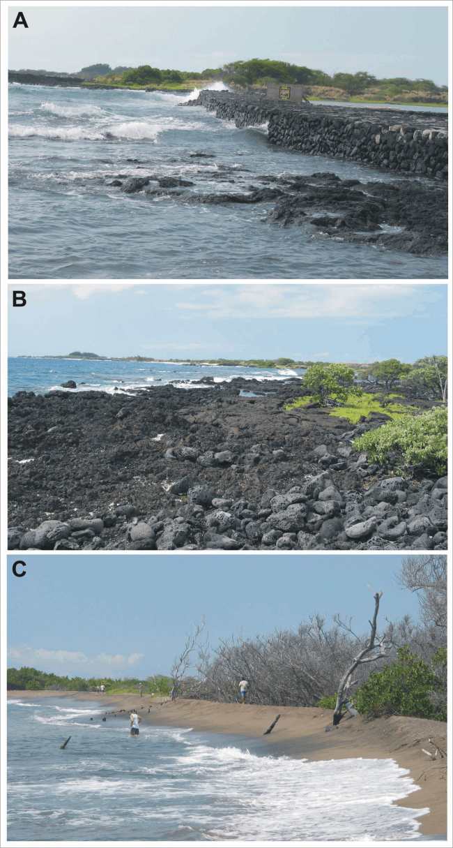
Figure 4. Photos of different geomorphologic settings within Kaloko-Honokohau National Historical Park. A) A view looking north from the Kaloko Fishpond, this area is ranked as high vulnerability with respect to geomorphology due to manmade structures and rubble beaches. B) The rocky shoreline at Kaloko Point is ranked as moderate vulnerability. C) The beach fronting the Aimakapa Fishpond is ranked as very high vulnerability with respect to geomorphology. | ||
 |
||


![]() U.S. Department of the Interior |
U.S. Geological Survey
U.S. Department of the Interior |
U.S. Geological Survey
URL: http://pubsdata.usgs.gov/pubs/of/2005/1248/html/fig4.html
Page Contact Information: Publication Services
Page Last Modified: 22:06:54 Sat 12 Jan 2013