
Coastal Vulnerability Assessment of Kaloko-Honokohau National Historical Park to Sea-Level Rise
USGS Open-File Report 2005-1248
|
Coastal Vulnerability Assessment of Kaloko-Honokohau National Historical Park to Sea-Level Rise USGS Open-File Report 2005-1248 |
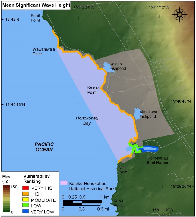
Figure 8. Mean significant wave heights for Kaloko-Honokohau National Historical Park based on NDBC data. The colored shoreline represents the mean significant wave heights within the park. The open coast is high vulnerability with respect to significant wave height; the lower vulnerability areas are within the sheltered Honokohau Harbor. | ||
 |
||


![]() U.S. Department of the Interior |
U.S. Geological Survey
U.S. Department of the Interior |
U.S. Geological Survey
URL: http://pubsdata.usgs.gov/pubs/of/2005/1248/html/fig8.html
Page Contact Information: Publication Services
Page Last Modified: 22:06:58 Sat 12 Jan 2013