U.S. Geological Survey Open-File Report 2005-1306
Continuous Resistivity Profiling Data from the Upper Neuse River Estuary, North Carolina, 2004-2005
|
|
2004 Measured Water Resistivity ProfilesThe table below contains previews of the 2004 resistivity profiles processed with the measured water resistivity value. Both the EarthImager JPEG image as well as the Matlab JPEG image of each processed file are presented. In addition, the trackline map below is a "clickable" map. By clicking on a line name, a new window will open with the processed images from that particular line segment. This includes the Matlab JPEG images (both with default and measured water resistivity values), as well as a reduced version of the EarthImager JPEG images (both with default and measured water resistivity values). The beginning of each line is shown with a triangle on the map, corresponding to the left side of the associated JPEG image, except where a single line has been broken into sequential parts. This should help orient the JPEG geographically.
|
Preview of Profiles: April 19-23, 2004 (click to enlarge)
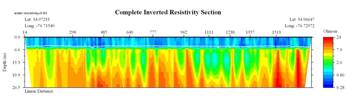
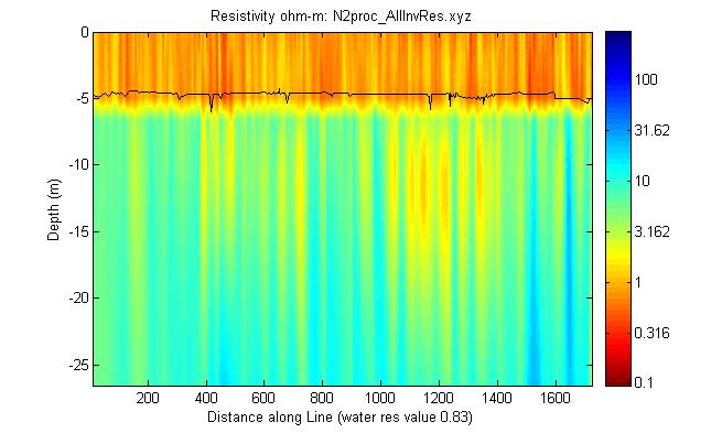
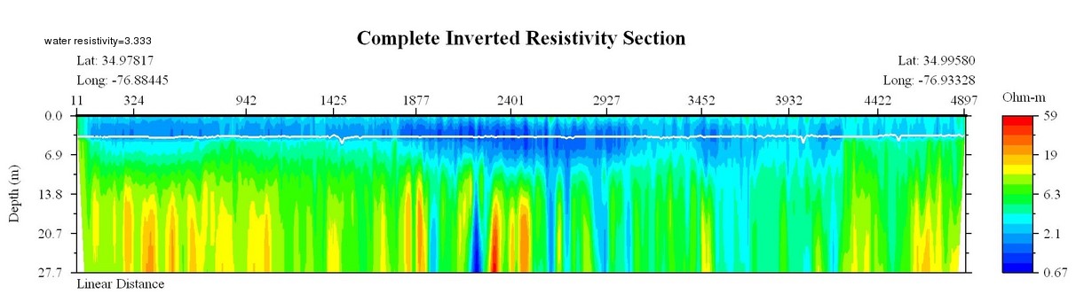
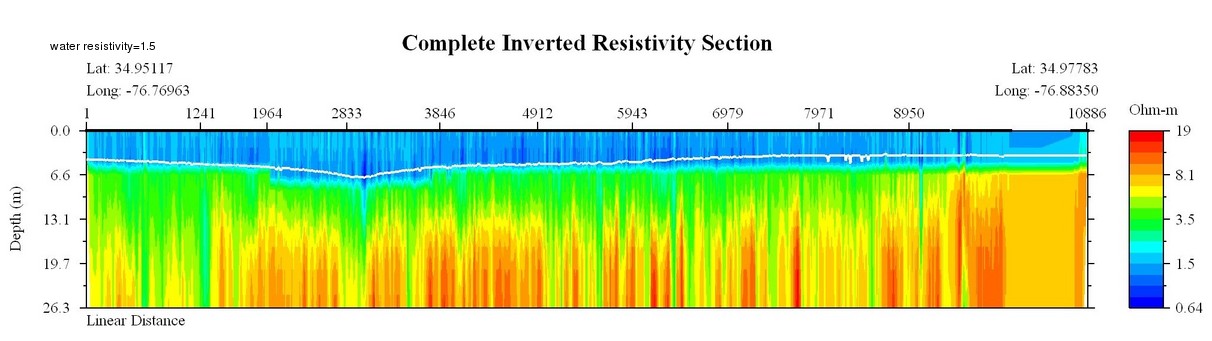
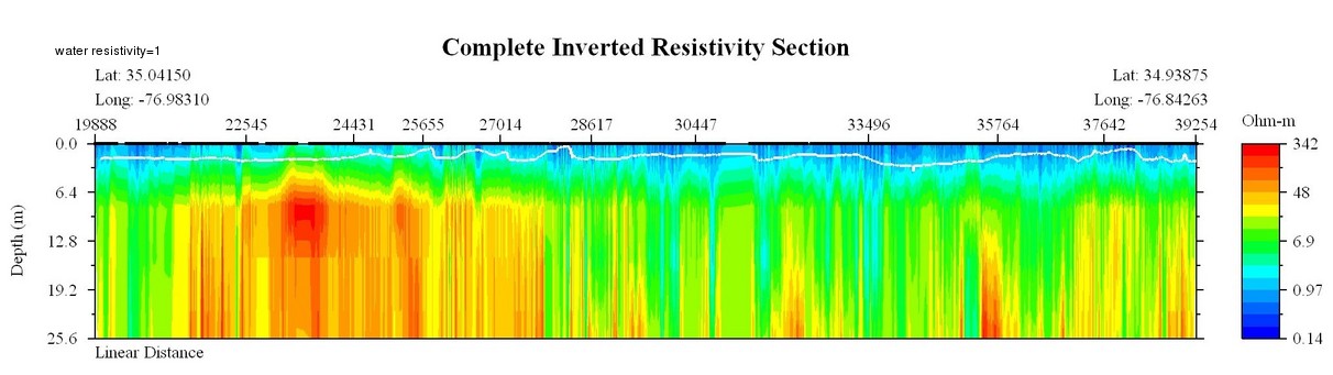
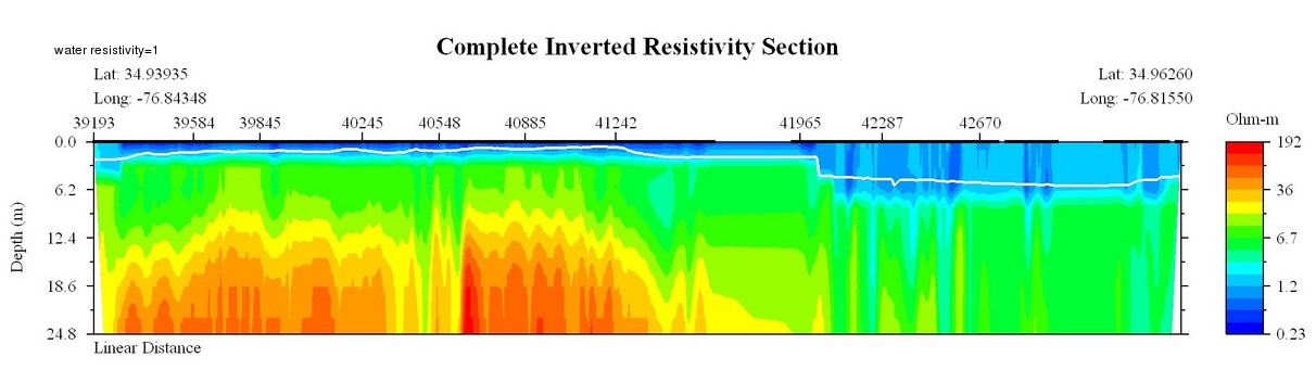
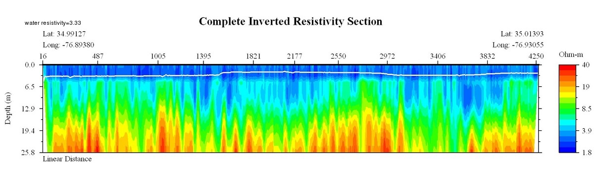
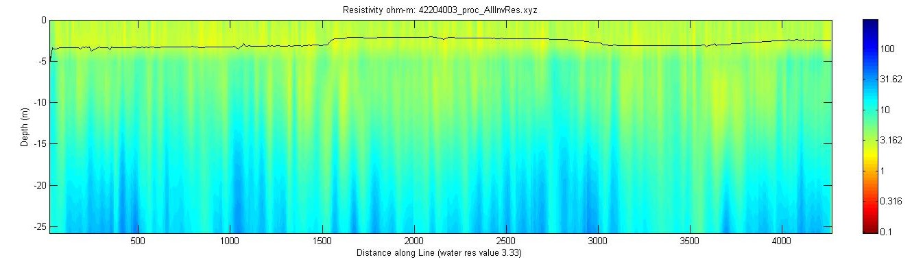
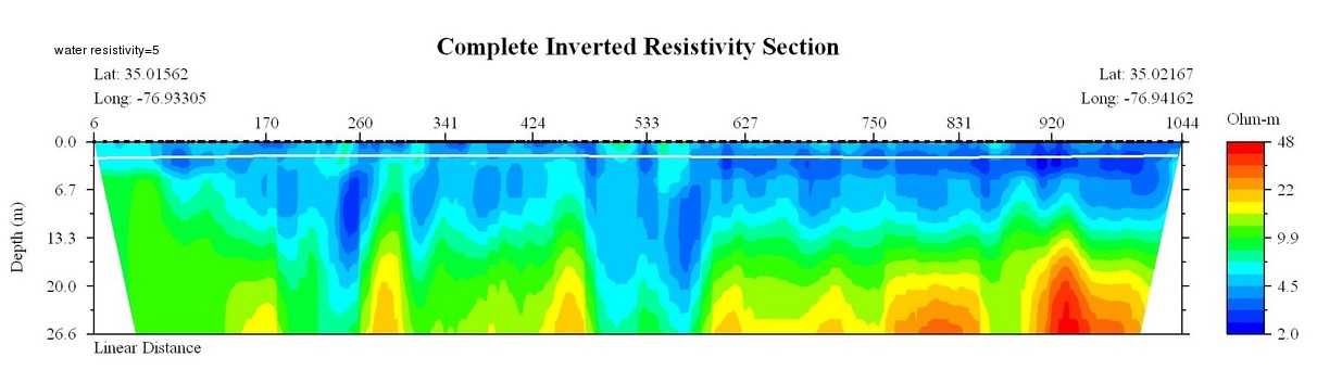
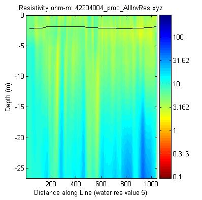
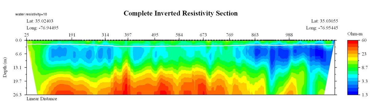
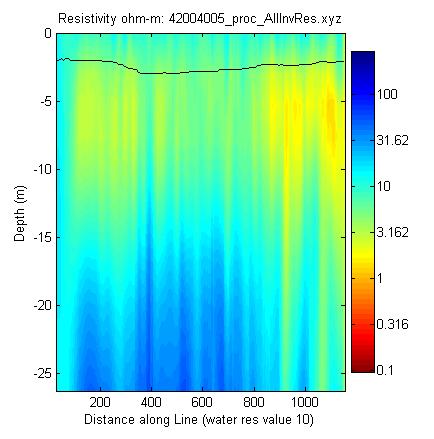
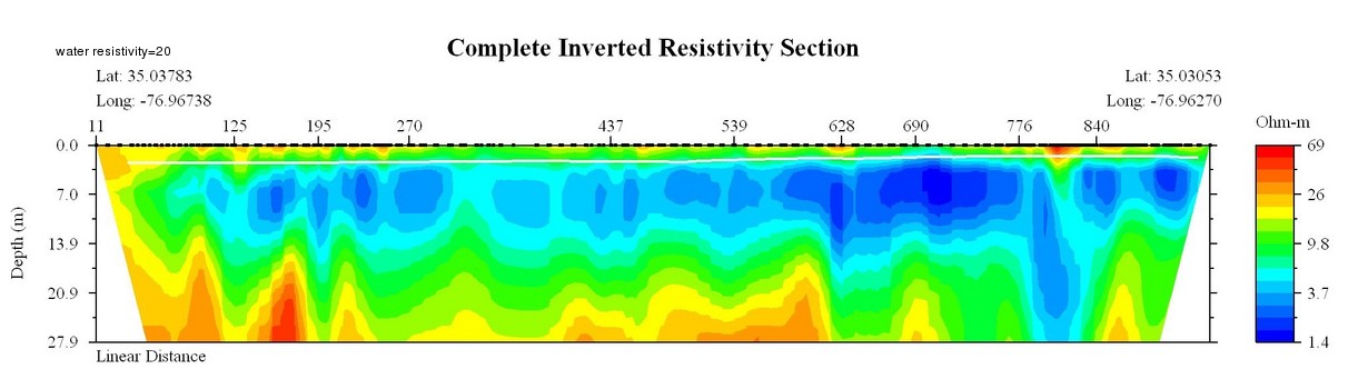
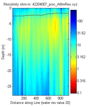
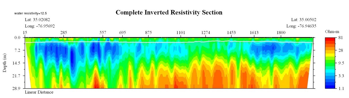
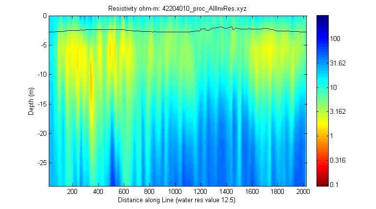
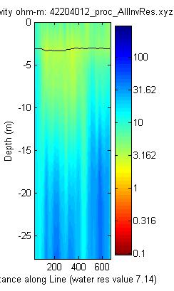
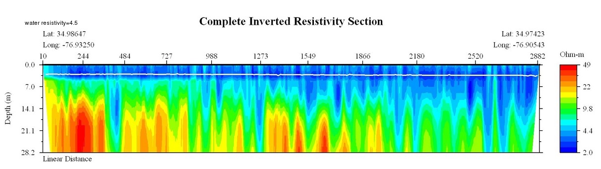
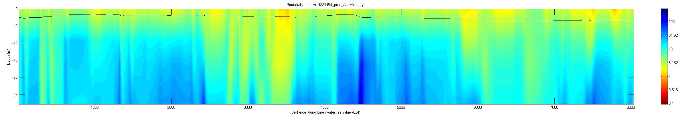
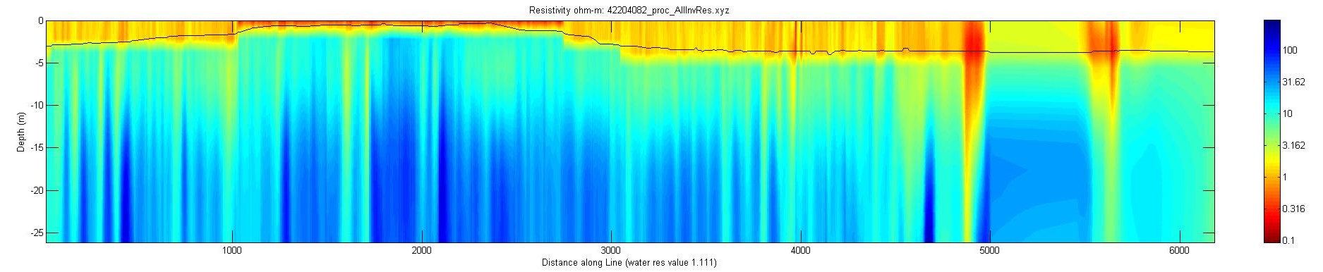
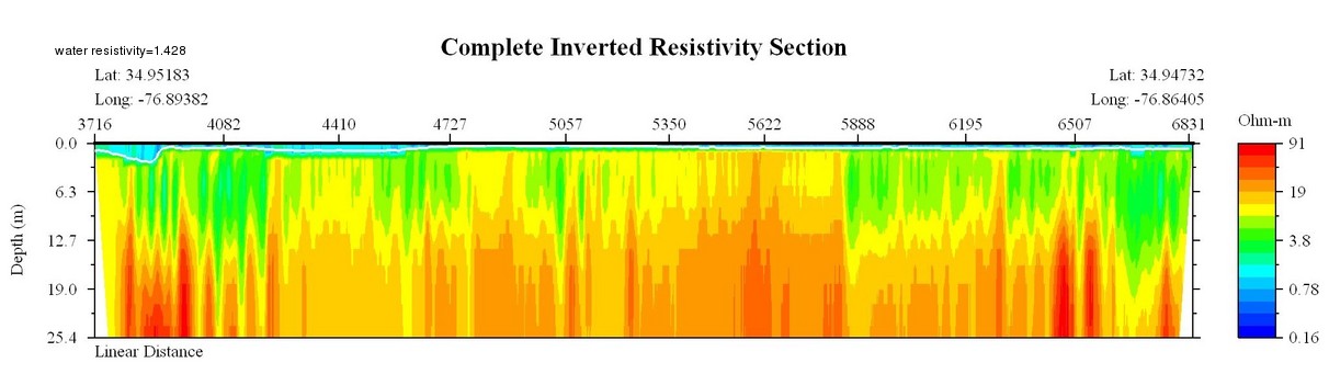
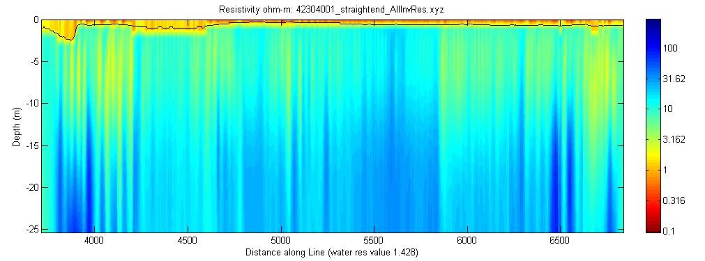
All profiles were created using a measured average water resistivity value for each line during processing. The white or black line in the image is the water depth as measured by the fathometer. WRES refers to the water resistivity value used during processing.
| EarthImager version | Matlab version |
| April 19, 2004: Line N2, WRES = 0.83
|
|
April 20, 2004: Line 25, WRES = 3.333
|
|
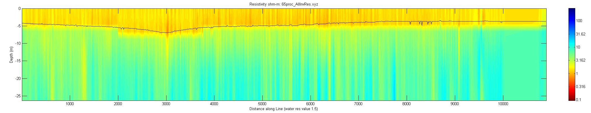
April 20, 2004: Line 65, WRES = 1.5
|
|
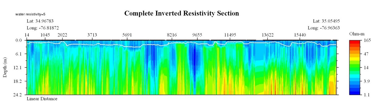
April 21, 2004 Line 42104001_part1, WRES = 5
|
|
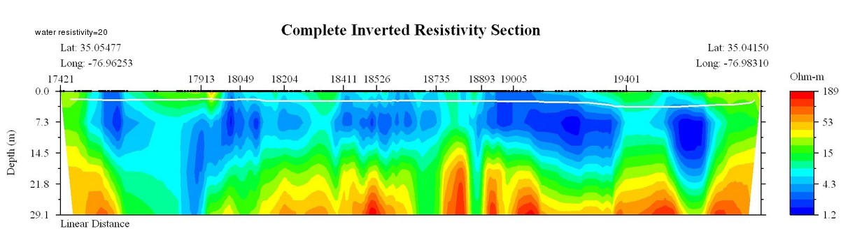
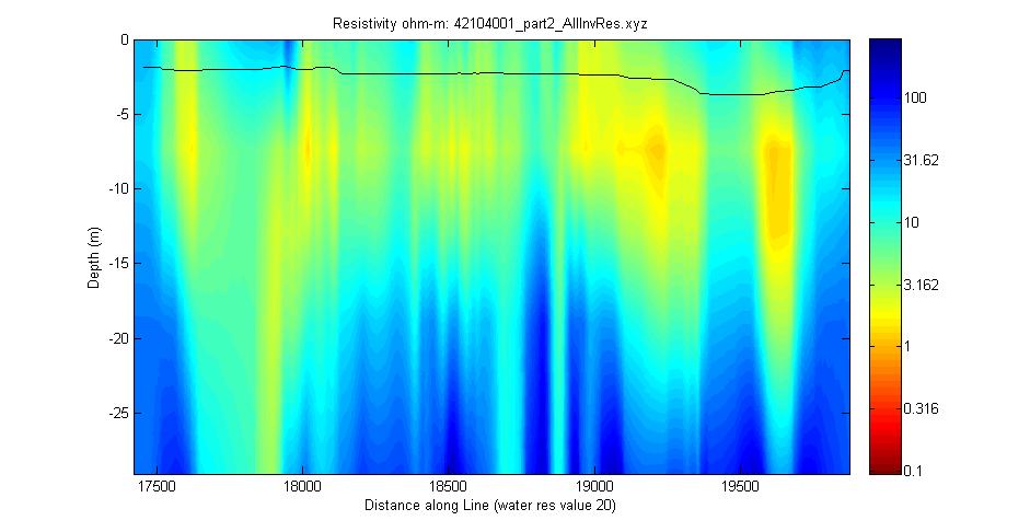
April 21, 2004 Line 42104001_part2, WRES = 20
|
|
April 21, 2004 Line 42104001_part3, WRES = 1
|
|
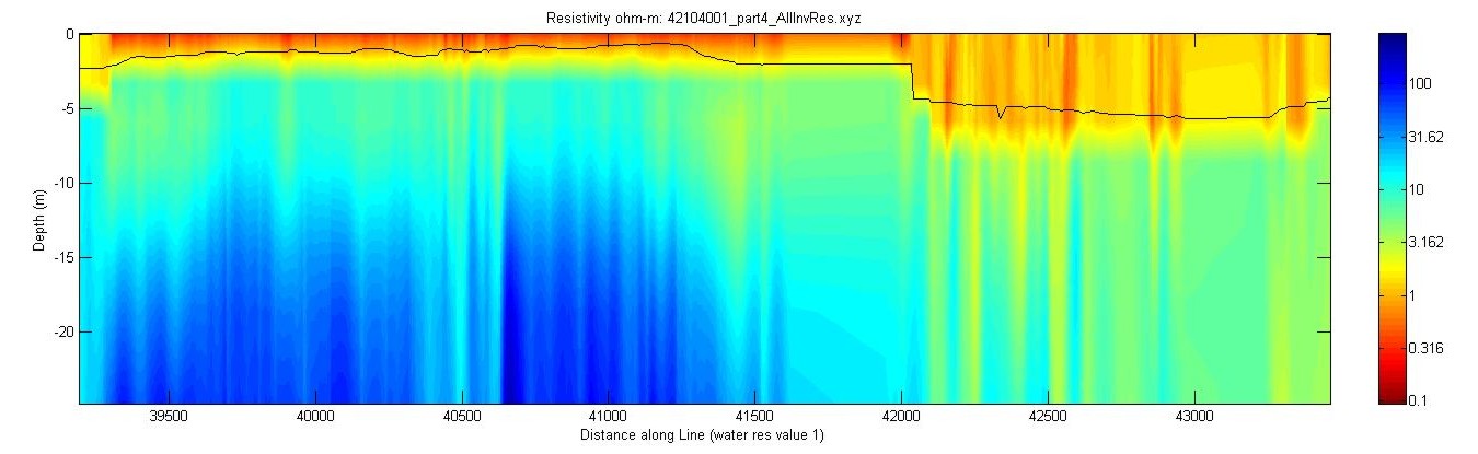
April 21, 2004 Line 42104001_part4, WRES = 1
|
|
| April 22, 2004: Line 42104002, WRES = 2
|
|
April 22, 2004: Line 42204003, WRES = 3.33
|
|
April 22, 2004: Line 42204004, WRES = 5
|
|
April 22, 2004 Line 42004005, WRES = 10
|
|
April 22, 2004 Line 42204007, WRES = 20
|
|
April 22, 2004 Line 42204010, WRES = 12.5
|
|
April 22, 2004 Line 42204012, WRES = 7.14
|
|
April 22, 2004 Line 42204014, WRES = 4.5
|
|
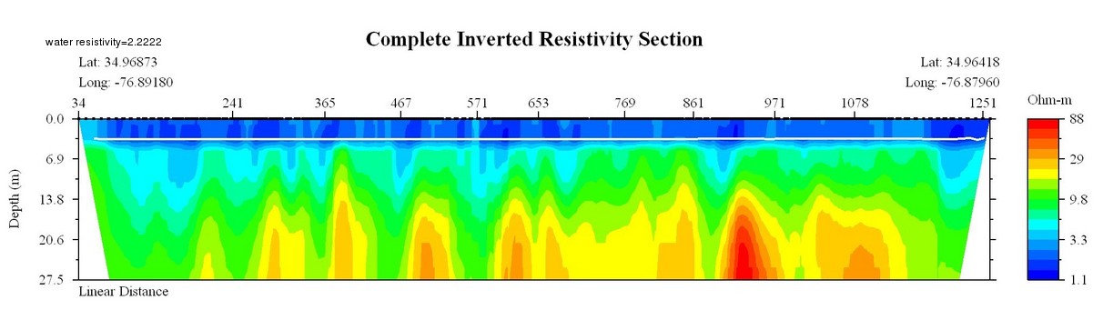
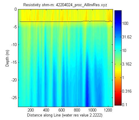
April 22, 2004 Line 42204024, WRES = 2.2222
|
|
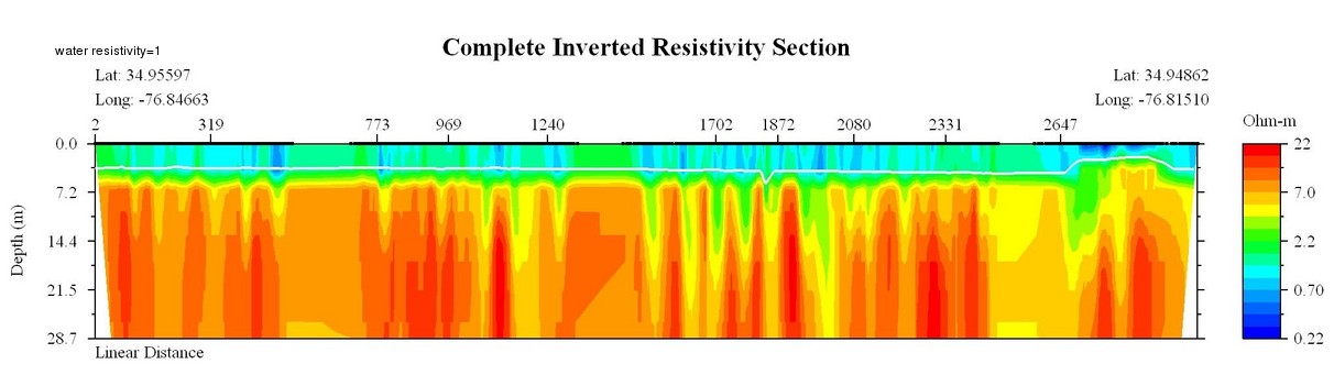
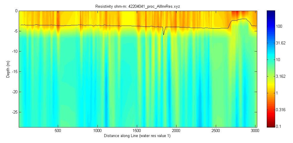
April 22, 2004 Line 42204041, WRES = 1
|
|
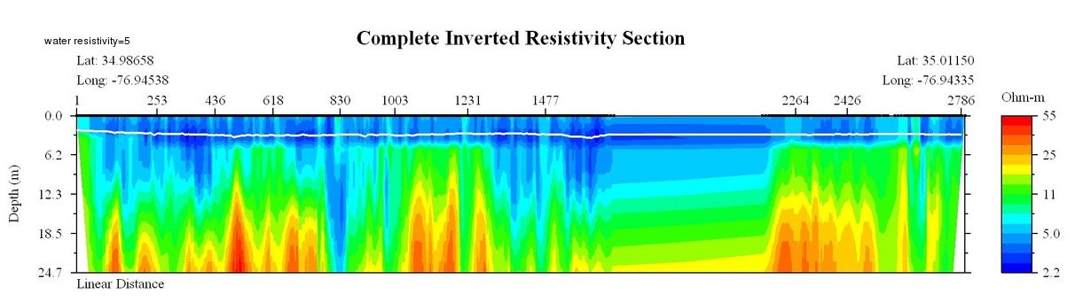
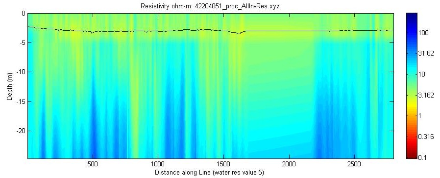
April 22, 2004 Line 42204051, WRES = 5
|
|
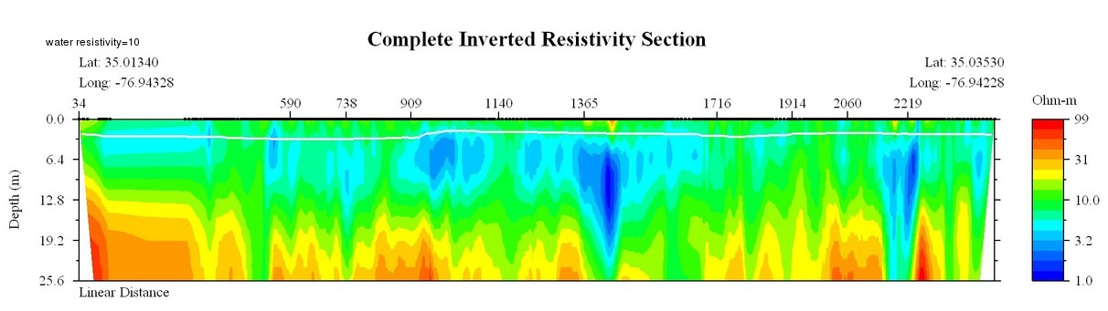
April 22, 2004 Line 42204053, WRES = 10
|
|
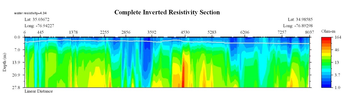
April 22, 2004 Line 4220454, WRES = 4.34
|
|
April 22, 2004 Line 42204082, WRES = 1.111
|
|
| April 23, 2004 Line 42304001, WRES = 1.428
|
|
![]()
![]() U.S. Department of the Interior |
U.S. Geological Survey
U.S. Department of the Interior |
U.S. Geological Survey
URL: pubsdata.usgs.gov/pubs/of/2005/1306/htmldocs/2004prev_wres.htm
Page Contact Information: Publishing Services
Page Last Modified: Saturday, 12-Jan-2013 22:07:38 EST