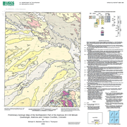
This digital geologic map presents new polygon (geologic map unit contacts) and line (terrace and lacustrine spit/barrier bar) vector data for a map comprised of four 7.5-minute quadrangles in the northwestern part of the Alamosa 1:100,000-scale quadrangle. The 7.5-minute quadrangles include the Alamosa East, Alamosa West, La Jara, and Pikes Stockade. The map database, compiled at 1:50,000-scale resolution, provides geologic coverage of an area of current hydrogeologic, tectonic, and stratigraphic interest. The mapped area is located in Alamosa and Conejos Counties and includes the town of Alamosa in its northern part. The map area is mainly underlain by surficial geologic materials (fluvial and lacustrine deposits, eolian sand), but Tertiary volcanic and volcaniclastic rocks crop out in the San Luis Hills, which are on the south margin of the mapped area. The surficial geology of this area has never been mapped in any scale greater than 1:250,000 (broad reconnaissance), so this new map provides important data for ground-water assessments, engineering geology, and the Quaternary geologic history of the San Luis Basin. Of particular interest are newly discovered shoreline deposits (sands and gravels) associated with the high stand of Lake Alamosa, a Pliocene to middle Pleistocene lake that occupied the San Luis Basin prior to its overflow and cutting of a river gorge through the San Luis Hills. After the lake drained, the Rio Grande system included Colorado drainages for the first time since the Miocene? (5 Ma). This map provides new geologic information for better understanding groundwater flow paths in and adjacent to the Rio Grande system.
|
