Link to USGS home page.
Open-File Report 2005–1418
  About USGS /  Science Topics /  Maps, Products & Publications /  Education / FAQ

Preliminary Geologic Map of the Albuquerque 30’ x 60’ Quadrangle, north-central New Mexico

By Paul L. Williams and James C. Cole

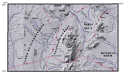
thumbnail of figure 1 within report

Introduction

This report describes the geology of the Albuquerque 30’ x 60’ quadrangle in north-central New Mexico. The compilation summarizes and integrates recent geologic mapping and various topical studies carried out between 1996 and 2002 under the U.S. Geological Survey (USGS) study of the “Middle Rio Grande Basin” by geologists from the USGS, the New Mexico Bureau of Geology and Mineral Resources (NMBGMR), the University of New Mexico, the American Museum, the Arizona Geological Survey, the South Dakota School of Mines and Technology, Washington University, and consulting firms. This study was undertaken to investigate geologic factors that influence ground-water resources of the Middle Rio Grande Basin, and to provide, at a regional scale, new insights into the complex geology of this portion of the Rio Grande rift.

Version 1.0

Posted January 2006

Part or all of this report is presented in Portable Document Format (PDF); the latest version of Adobe Acrobat Reader or similar software is required to view it. Download the latest version of Acrobat Reader, free of charge.


For viewing and printing upon download.
(This version of the report is accessible as defined in Section 508 of the Rehabilitation Act of 1973, Amendments of 1998.)
(The Description of Map Units is accessible as defined in Section 508 of the Rehabilitation Act of 1973, Amendments of 1998.)
The metadata and data files are contained in a gzipped tar or zip archive. Please refer to the README file for detailed information on the use of this publication.
USA.gov logo