|
We report the chemical analyses for rocks, soil, soil water,
and vegetation, collected from throughout the Big Delta B-2 quadrangle
in east-central Alaska, for the period 1998-2002. This study
focused on the integration of geology and bedrock geochemistry
with the geochemistry and biogeochemistry of soil and vegetation.
The study objectives were the characterization of the regional
tectonic setting, creation of a quadrangle geologic map, understanding
the effect of bedrock geology on the geochemical landscape signatures,
and the establishment of estimations of predevelopment geochemical
baseline concentrations for a variety of matrices. The impetus
for this work was the discovery in 1996 of the Pogo lode gold
deposit in the northwest corner of the quadrangle, the subsequent
increase in mineral exploration, and the overall mineral-occurrence
importance to the State and of the Yukon-Tanana Upland (Internal
Highlands Ecoregion). Geochemical data for the various rock units,
soil horizons, grayleaf willow, green alder, feather moss, and
soil-water extracts are given along with the analytical methodology
used. The data are being released at this time with minimal interpretation.
DOWNLOAD a PDF file of the report [1.9 MB]
DOWNLOAD a Microsoft Excel™
file of tables 1-12 [632 KB]
DOWNLOAD Adobe Reader™ free of charge
|
|
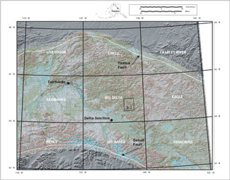
Index map showing the location of the Big Delta B-2 quadrangle in east-central Alaska |

