
Open-File Report 2006-1008
Title Page /
Table of Contents /
List of Figures /
Introduction /
Maps / Data Collection/Processing / Interpretation / Acknowledgments / Appendix 1 / Appendix 2 /
Appendix 3 /
 |
||
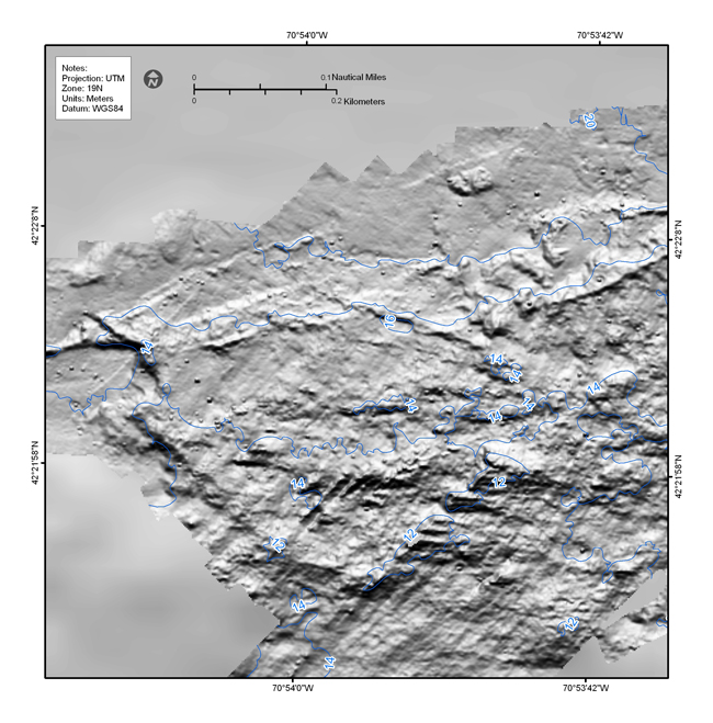
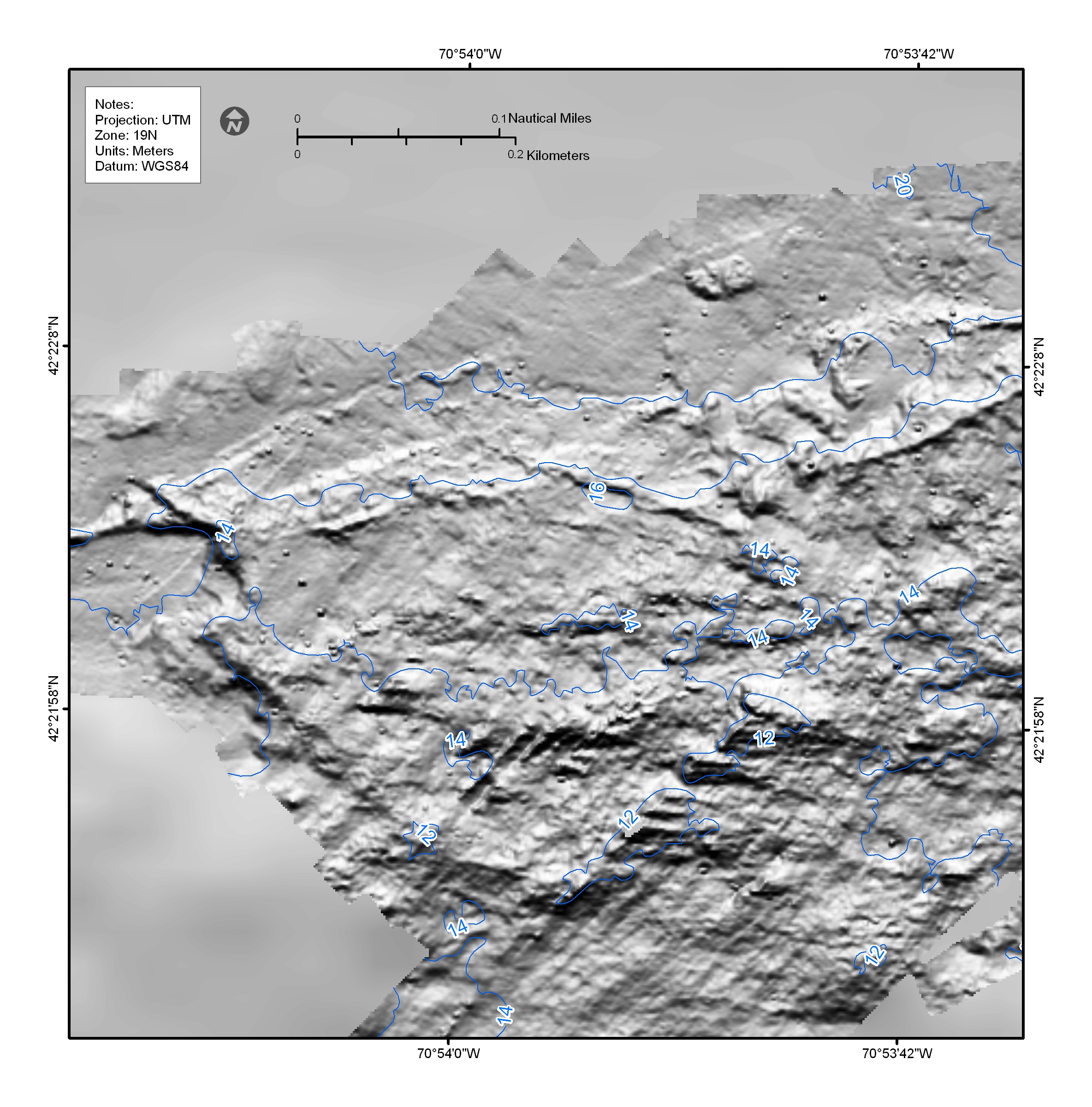
Figure 4.19. Shaded-relief bathymetric map showing numerous individual targets 4-6 m on a side and less than a meter high that are interpreted to be individual boulders. Similar targets are observed in the 2-m multibeam bathymetry in nearly all of the areas with a rough sea floor. See Figure 4.2 for map location. | ||

![]() U.S. Department of the Interior |
U.S. Geological Survey
U.S. Department of the Interior |
U.S. Geological Survey
URL: http://pubsdata.usgs.gov/pubs/of/2006/1008/html/imagepages/f4_19.html
Page Contact Information: GS Pubs Web Contact
Page Last Modified: Friday, 02-Aug-2024 11:46:42 EDT


