Open-File Report 2006-1008
Title Page /
Table of Contents /
List of Figures /
Introduction /
Maps / Data Collection/Processing / Interpretation / Acknowledgments / Appendix 1 / Appendix 2 /
Appendix 3 /
 |
||
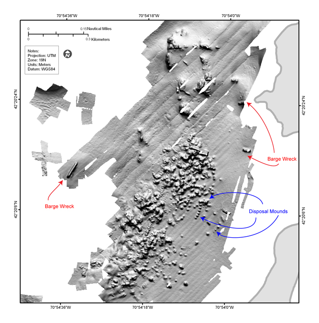
Figure 4.20. Shaded-relief bathymetry bathymetric map of the area west of Great Brewster and Calf Island showing barge wrecks and mounds of dredged material on the sea floor. See Figure 4.2 for map location. | ||