Open-File Report 2006-1008
Title Page /
Table of Contents /
List of Figures /
Introduction /
Maps / Data Collection/Processing / Interpretation / Acknowledgments / Appendix 1 / Appendix 2 /
Appendix 3 /
 |
||
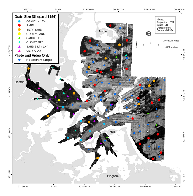
Figure 4.3. Texture of surficial sediments, based on Shepard classification, superimposed on gray-scale sidescan-sonar mosaic of Boston Harbor and Approaches. Dark blue dots indicate sites where no sample was collected and photographs show the sea floor is bedrock or covered with boulders, cobble or shells. Low backscatter intensity corresponds to areas of fine-grained sediments (silt and clay, Inner Harbor) or sandy sediments (Approaches). High backscatter intensity corresponds to areas of gravel, boulders, or outcropping bedrock (areas that could not be sampled with the grab sampler). See Appendix 2 for sediment texture and Appendix 3 for bottom photographs. See map sheet 5 for figure at a scale of 1:60,000. | ||