
Open-File Report 2006-1008
Title Page /
Table of Contents /
List of Figures /
Introduction /
Maps / Data Collection/Processing / Interpretation / Acknowledgments / Appendix 1 / Appendix 2 /
Appendix 3 /
 |
||
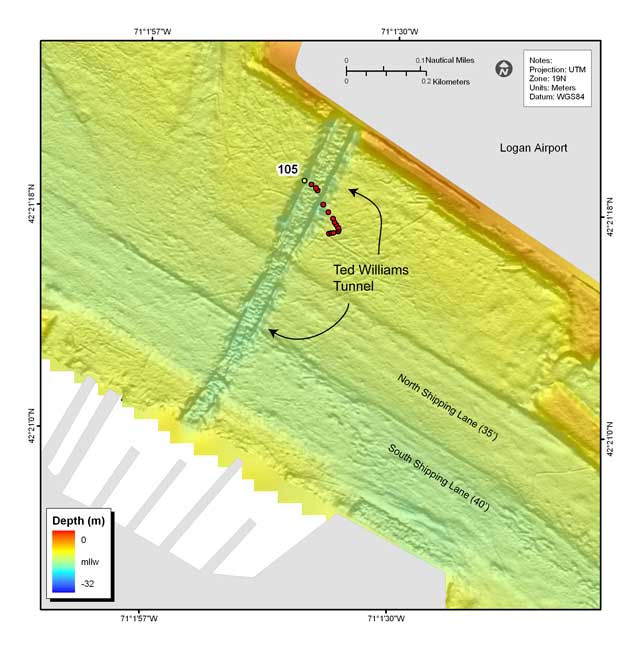
Figure 4.5. Shaded relief bathymetry, colored by water depth, showing the Ted Williams Tunnel as it crosses Boston Inner Harbor from south | ||

![]() U.S. Department of the Interior |
U.S. Geological Survey
U.S. Department of the Interior |
U.S. Geological Survey
URL: http://pubsdata.usgs.gov/pubs/of/2006/1008/html/imagepages/f4_5.html
Page Contact Information: GS Pubs Web Contact
Page Last Modified: Friday, 02-Aug-2024 11:47:02 EDT


