Open-File Report 2006–1058

U.S. GEOLOGICAL SURVEY
Open-File Report 2006–1058
Back to Table of Contents

Figure - refer to figure caption for alternative text description

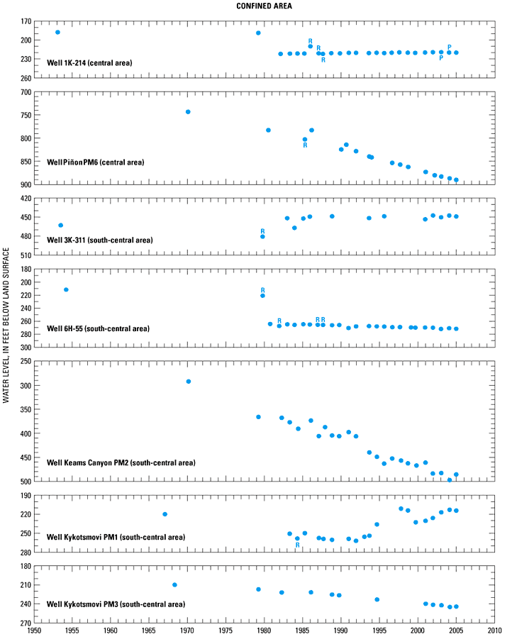
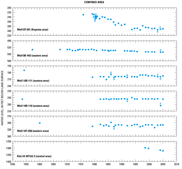
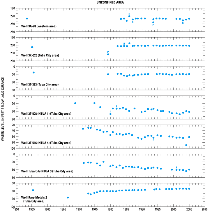
Figure 7. Observed water levels (1950–2005) in annual observation well network, Black Mesa area, Arizona.

P, pumping; R, recently pumping.
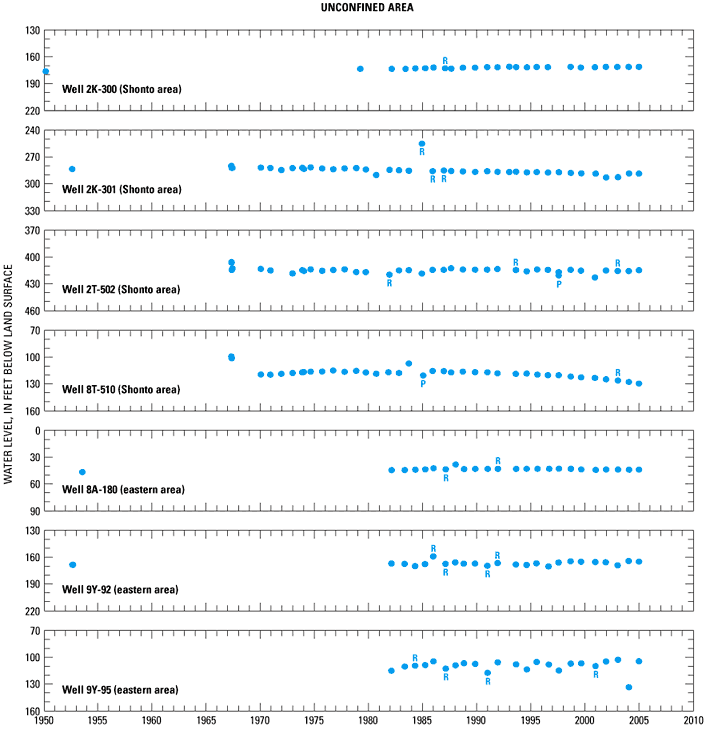
Figure - refer to figure caption for alternative text description

Figure 7. Continued.

Figure - refer to figure caption for alternative text description

Figure 7. Continued.

Figure - refer to figure caption for alternative text description

Figure 7. Continued.

Back to Table of Contents

For more information about USGS activities in Arizona, visit the USGS Arizona Water Science Center home page.


AccessibilityFOIAPrivacyPolicies and Notices

Take Pride in America home page.FirstGov buttonU.S. Department of the Interior | U.S. Geological Survey
Persistent URL: http://pubs.water.usgs.gov/sir
Page Contact Information: Publications Team
Page Last Modified: Saturday, 12-Jan-2013 21:07:59 EST