Open-File Report 2006-1059
![]() Title | Geologic Setting | Introduction
| Methods | Bathymetric Overview |
Interpretation | Data Catalog
| Acknowledgments | References
| Figures
| Contacts
Title | Geologic Setting | Introduction
| Methods | Bathymetric Overview |
Interpretation | Data Catalog
| Acknowledgments | References
| Figures
| Contacts
 |
||
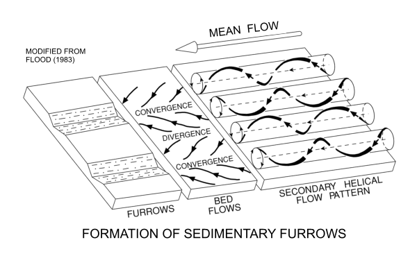
Figure 16. Schematic representation showing a possible mechanism (modified from Flood (1983) for the formation of sedimentary furrows in southeastern Long Island Sound. Secondary helical flow patterns sweep coarse material, such as nucula shells or sand, into linear zones of convergence. These relatively coarse particles are driven by tidal currents and cut furrows into soft, cohesive sediments. | ||

![]() U.S. Department of the Interior |
U.S. Geological Survey
U.S. Department of the Interior |
U.S. Geological Survey
URL: http://pubsdata.usgs.gov/pubs/of/2006/1059/html/fig16.html
Page Contact Information: GS Pubs Web Contact
Page Last Modified: Tuesday, 16-Sep-2025 16:10:50 EDT
