Open-File Report 2006-1059
![]() Title | Geologic Setting | Introduction
| Methods | Bathymetric Overview |
Interpretation | Data Catalog
| Acknowledgments | References
| Figures
| Contacts
Title | Geologic Setting | Introduction
| Methods | Bathymetric Overview |
Interpretation | Data Catalog
| Acknowledgments | References
| Figures
| Contacts
 |
||
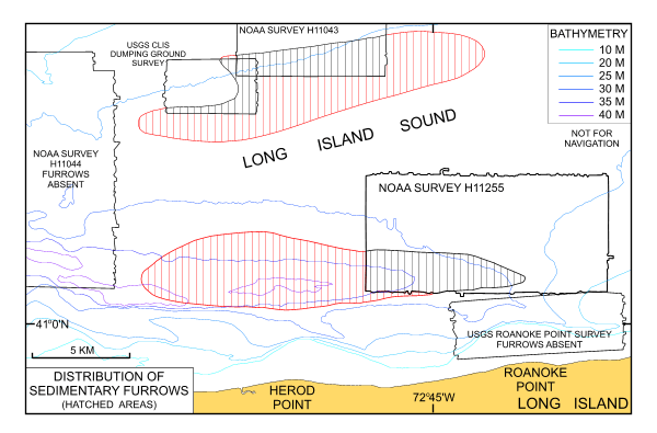
Figure 17. Map showing the distribution of sedimentary furrows in east-central Long Island Sound. Areas where sedimentary furrows have been observed are shown in black hatching; areas where the furrows are interpreted to occur are shown in red hatching. | ||

![]() U.S. Department of the Interior |
U.S. Geological Survey
U.S. Department of the Interior |
U.S. Geological Survey
URL: http://pubsdata.usgs.gov/pubs/of/2006/1059/html/fig17.html
Page Contact Information: GS Pubs Web Contact
Page Last Modified: Tuesday, 16-Sep-2025 16:11:35 EDT
