Open-File Report 2006-1059
![]() Title | Geologic Setting | Introduction
| Methods | Bathymetric Overview |
Interpretation | Data Catalog
| Acknowledgments | References
| Figures
| Contacts
Title | Geologic Setting | Introduction
| Methods | Bathymetric Overview |
Interpretation | Data Catalog
| Acknowledgments | References
| Figures
| Contacts
 |
||
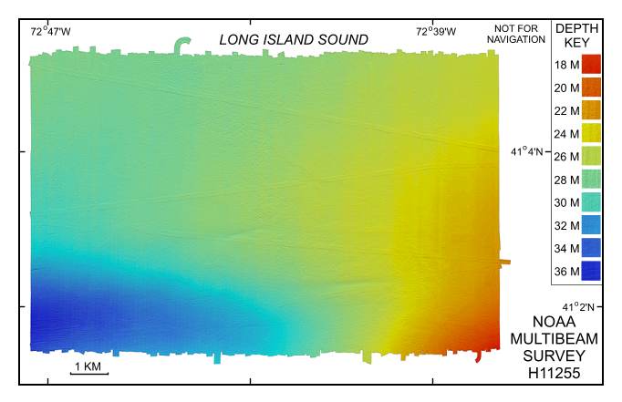
Figure 4. Digital terrain model (DTM) of the sea floor in southeastern Long Island Sound produced from multibeam bathymetry collected during NOAA survey H11255. Image is sun-illuminated from the north and vertically exaggerated 10X. Hotter colors are shallower areas; cooler colors are deeper areas. See key for depth ranges. | ||

![]() U.S. Department of the Interior |
U.S. Geological Survey
U.S. Department of the Interior |
U.S. Geological Survey
URL: http://pubsdata.usgs.gov/pubs/of/2006/1059/html/fig4.html
Page Contact Information: GS Pubs Web Contact
Page Last Modified: Tuesday, 16-Sep-2025 16:00:03 EDT
