Open-File Report 2006-1260-G
Prepared in cooperation with the Commonwealth of Massachusetts, Office of the State Geologist and Executive Office of Energy and Environmental Affairs
Compiled by Janet R. Stone and Mary L. DiGiacomo-Cohen
|
Explanatory Text (19 pages, 8.5x11 inches) [894-KB PDF] |
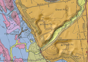
IntroductionThe surficial geologic map layer shows the distribution of nonlithified earth materials at land surface in an area of 24 7.5-minute quadrangles (1,238 mi2 total) in west-central Massachusetts. Across Massachusetts, these materials range from a few feet to more than 500 ft in thickness. They overlie bedrock, which crops out in upland hills and as resistant ledges in valley areas. The geologic map differentiates surficial materials of Quaternary age on the basis of their lithologic characteristics (such as grain size and sedimentary structures), constructional geomorphic features, stratigraphic relationships, and age. Surficial materials also are known in engineering classifications as unconsolidated soils, which include coarse-grained soils, fine-grained soils, and organic fine-grained soils. Surficial materials underlie and are the parent materials of modern pedogenic soils, which have developed in them at the land surface. Surficial earth materials significantly affect human use of the land, and an accurate description of their distribution is particularly important for assessing water resources, construction aggregate resources, and earth-surface hazards, and for making land-use decisions. This work is part of a comprehensive study to produce a statewide digital map of the surficial geology at a 1:24,000-scale level of accuracy. This report includes explanatory text, quadrangle maps at 1:24,000 scale (PDF files), GIS data layers (ArcGIS shapefiles), metadata for the GIS layers, scanned topographic base maps (TIF), and a readme.txt file. |
To order maps, publications, and other miscellaneous products on paper and compact disc media from the USGS: |
Document Accessibility: Adobe Systems Incorporated has information about PDFs and the visually impaired. This information provides tools to help make PDF files accessible. These tools convert Adobe PDF documents into HTML or ASCII text, which then can be read by a number of common screen-reading programs that synthesize text as audible speech. In addition, an accessible version of Acrobat Reader 7.0 for Windows (English only), which contains support for screen readers, is available. These tools and the accessible reader may be obtained free from Adobe at Adobe Access. Suggested citation: Stone, J.R., and DiGiacomo-Cohen, M.L., comps., 2010, Surficial geologic map of the Heath-Northfield-Southwick-Hampden 24-quadrangle area in the Connecticut Valley region, west-central Massachusetts: U.S. Geological Survey Open-File Report 2006-1260-G. |

![]() U.S. Department of the Interior |
U.S. Geological Survey
U.S. Department of the Interior |
U.S. Geological Survey
URL: http://pubsdata.usgs.gov/pubs/of/2006/1260/G/index.html
Page Contact Information: Publishing Services
Page Last Modified: Saturday, 12-Jan-2013 22:26:05 EST