
Open-File Report 2006-1357
![]() Title |
Introduction |
Setting |
Methods |
Overview |
Interpretation |
Discussion |
Data Catalog |
Acknowledgments |
References |
Figures |
Bottom Photographs |
Sediment Data |
Contacts
Title |
Introduction |
Setting |
Methods |
Overview |
Interpretation |
Discussion |
Data Catalog |
Acknowledgments |
References |
Figures |
Bottom Photographs |
Sediment Data |
Contacts
 |
||
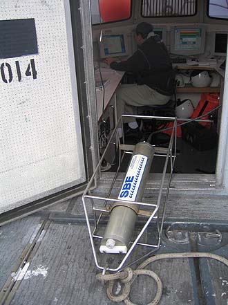
Figure 13. CTD (conductivity-temperature-depth) profiler shown on the deck of the NOAA ship THOMAS JEFFERSON. Data derived from frequent deployments of this device were used to perfom sound-velocity corrections on the multibeam data. | ||

![]() U.S. Department of the Interior |
U.S. Geological Survey
U.S. Department of the Interior |
U.S. Geological Survey
URL: http://pubsdata.usgs.gov/pubs/of/2006/1357/html/fig13.html
Page Contact Information: GS Pubs Web Contact
Page Last Modified: Thursday, 19-Sep-2024 13:36:40 EDT


