
Open-File Report 2006-1357
![]() Title |
Introduction |
Setting |
Methods |
Overview |
Interpretation |
Discussion |
Data Catalog |
Acknowledgments |
References |
Figures |
Bottom Photographs |
Sediment Data |
Contacts
Title |
Introduction |
Setting |
Methods |
Overview |
Interpretation |
Discussion |
Data Catalog |
Acknowledgments |
References |
Figures |
Bottom Photographs |
Sediment Data |
Contacts
 |
||
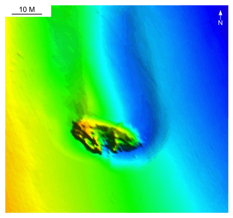
Figure 42. Detailed planar view of scour associated with a shipwreck in the large depression north of Quicks Hole from the DTM produced during NOAA survey H11076. Scour depression asymmetry indicates that net transport is to the north (upper part of image). Location of view is shown in figure 22. | ||

![]() U.S. Department of the Interior |
U.S. Geological Survey
U.S. Department of the Interior |
U.S. Geological Survey
URL: http://pubsdata.usgs.gov/pubs/of/2006/1357/html/fig42.html
Page Contact Information: GS Pubs Web Contact
Page Last Modified: Thursday, 19-Sep-2024 14:09:18 EDT


