| Name | Rng | Twsp | Sect | Legl | Elev | TD | USGS_ID | Lithology | Gamma | Neutron | SP | SPR | Construction | Aquifer Test | Water Levels | Well Record (JPG) |
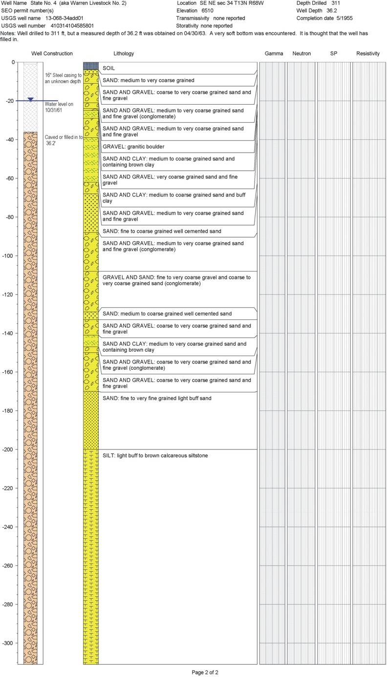
| State no 4 | 68W | 13N | 34 | SE/NE | 6510 | 311 | 410314104585801 | D/G | C | P | √ | |||||
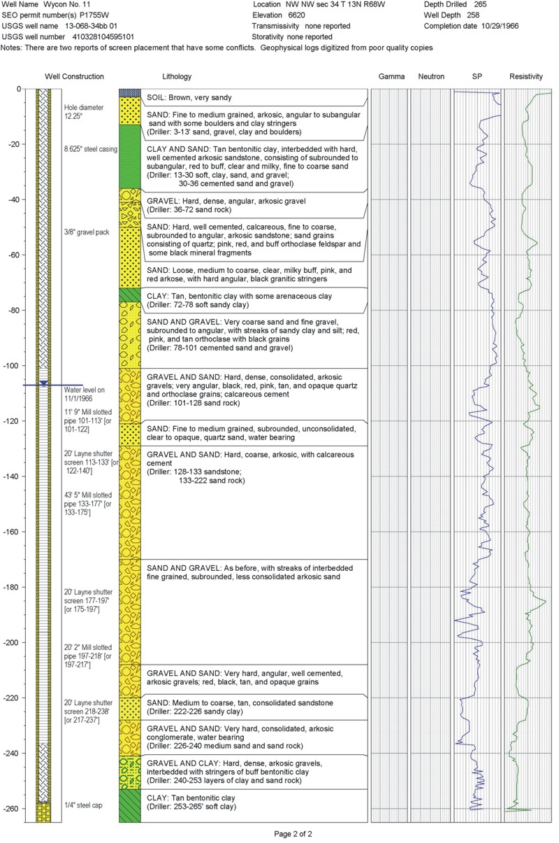
| Wycon no 11 | 68W | 13N | 34 | NW/NW | 6620 | 265 | 410328104595101 | G | D | D | D | I | √ | |||
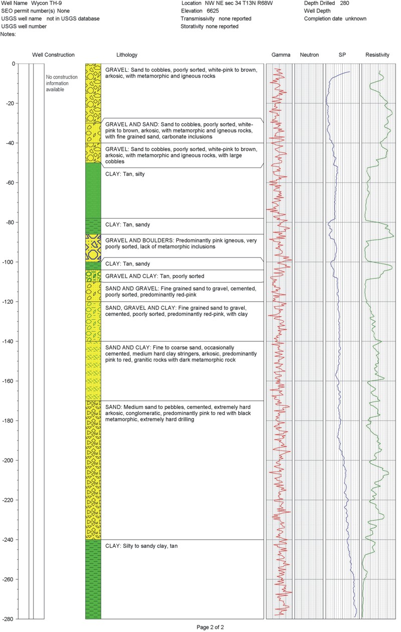
| Wycon TH 9 | 68W | 13N | 34 | NW/NE | 6625 | 280 | G | D | D | D | TU | √ | ||||