
Open-File Report 2007-1138
Sea-Floor Character and Sedimentary Processes of Great Round Shoal Channel, Offshore Massachusetts
![]() Title |
Introduction |
Setting |
Methods |
Overview |
Discussion |
Interpretation |
Data Catalog |
Acknowledgments |
References |
Figures |
Bottom Photographs |
Sediment Data |
Contacts
Title |
Introduction |
Setting |
Methods |
Overview |
Discussion |
Interpretation |
Data Catalog |
Acknowledgments |
References |
Figures |
Bottom Photographs |
Sediment Data |
Contacts
 |
||
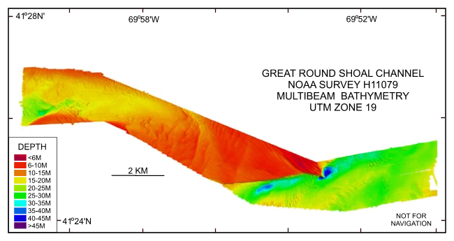
Figure 20. Digital terrain model (DTM) of the sea floor produced from multibeam bathymetry collected during NOAA survey H11079 of Great Round Shoal Channel, offshore Massachusetts. Image is sun-illuminated from the north and vertically exaggerated 5x. Hotter colors are shallower areas; cooler colors are deeper areas. See key for depth ranges. | ||

![]() U.S. Department of the Interior |
U.S. Geological Survey
U.S. Department of the Interior |
U.S. Geological Survey
URL: http://pubsdata.usgs.gov/pubs/of/2007/1138/html/fig20.html
Page Contact Information: GS Pubs Web Contact
Page Last Modified: Friday, 03-Jan-2025 14:56:54 EST


