
Open-File Report 2007-1138
Sea-Floor Character and Sedimentary Processes of Great Round Shoal Channel, Offshore Massachusetts
![]() Title |
Introduction |
Setting |
Methods |
Overview |
Discussion |
Interpretation |
Data Catalog |
Acknowledgments |
References |
Figures |
Bottom Photographs |
Sediment Data |
Contacts
Title |
Introduction |
Setting |
Methods |
Overview |
Discussion |
Interpretation |
Data Catalog |
Acknowledgments |
References |
Figures |
Bottom Photographs |
Sediment Data |
Contacts
 |
||
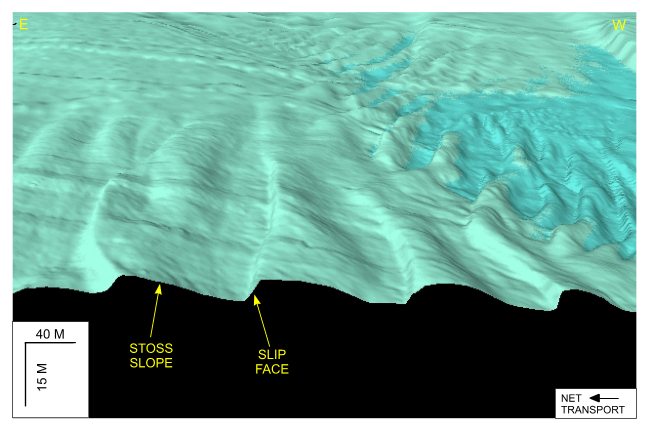
Figure 32. Detailed perspective view looking south of the transverse sand waves along the southern edge of Great Round Shoal from the DTM produced during NOAA survey H11079. Note that wave asymmetry and slip face orientation indicate net eastward transport. Scale bars are only valid in the foreground; location of view is shown in figure 22. | ||

![]() U.S. Department of the Interior |
U.S. Geological Survey
U.S. Department of the Interior |
U.S. Geological Survey
URL: http://pubsdata.usgs.gov/pubs/of/2007/1138/html/fig32.html
Page Contact Information: GS Pubs Web Contact
Page Last Modified: Friday, 03-Jan-2025 15:04:57 EST


