Western Coastal and Marine Geology
Giacomini Wetlands
Point Reyes National Seashore (PRNS), comprising unique elements of geological, biological, and historical interest, is located on the central California coast approximately 60 km northwest of San Francisco. The National Seashore contains nearly 130 km of exposed and protected shorelines, spectacular coastal cliffs and headlands, lagoons, open grasslands, bushy hillsides, and forested ridges. Approximately 30 km of the shoreline are coastal-dune habitat that supports 11 federally listed species, including the threatened western snowy plover and the endangered plants Tidestrom's lupine (Lupinus tidestromii) and beach layia (Layia carnosa). The San Andreas Fault, a right-lateral strike-slip fault, trends northwest along the northeastern side of the park.
Tomales Bay, which is straight, long, narrow, and shallow, runs along the northeastern boundary of PRNS. The Bay, which fills the northwestern end of a rift valley at the intersection of the San Andreas Fault with the coastline, is approximately 20 km long, 2 km wide, and 6 m deep with mountainous terrain to the southwest and rolling hills to the northeast. Tomales Bay is one of the cleanest estuaries on the West Coast. In winter, approximately 17,000 to 20,000 shorebirds inhabit Tomales Bay and Bodega Bay, which lies directly to the north.
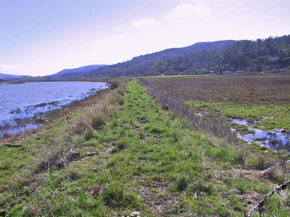
At the head of Tomales Bay, the Giacomini Ranch comprises 563 acres of pastureland currently being used for grazing dairy cattle. After more than 50 years of operation as a dairy, the National Park Service acquired the Giacomini property with the intention to restore most of it and the nearby Olema Marsh to tidal wetland. Restoration will add approximately 4% to the existing coastal wetlands in California. The project will return the headwaters of Tomales Bay and two major stream intersections to an intertidal marsh environment, enhancing habitat for both wildlife and fish populations and contributing to the long-term health of Tomales Bay.
Prior to the establishment of the ranch, the area was primarily salt marsh that formed as the delta of Lagunitas Creek expanded into Tomales Bay. In converting the salt marsh to dairy land, levees and tide gates were constructed to prevent tidal incursion and stream flooding. Those levees have significantly altered the patterns of estuarine circulation and sediment deposition. To restore natural hydrologic processes within the area and to promote the return of ecological functions and processes, the levees will have to be breached or removed.
Developing a successful restoration strategy requires knowledge of elevations within the pastureland and the range of water depths that can be expected from tidal, river, and wind action. In support of the restoration program, the USGS provides technical assistance to PRNS in the form of a scientific study focusing on understanding the physical processes that could affect the Giacomini wetland restoration. The study will yield scientific products that NPS resource managers can use in designing and implementing the restoration project. Research elements include:
As of November 2005, we have created a GCN, produced a detailed topographic map of the Giacomini site, and collected approximately three years of water-level and wind data at the Giacomini site and over one year of usable water-level data at the Sacramento Landing pier.
Download this report as a 31-page PDF document (of2007-1151.pdf; 2.6 MB)
For questions about the content of this report, contact John Dingler
Suggested citation and version history
Download a copy of the latest version of Adobe Reader for free.
| Help
| PDF help
| Publications main page | Open-File Reports for 2007 |
| Geologic
Division |
Western Coastal and Marine Geology
|

![]() U.S. Department of the Interior | U.S. Geological Survey
U.S. Department of the Interior | U.S. Geological Survey
URL: https://pubs.usgs.gov/of/2007/1151/
Page Contact Information: Michael Diggles
Page Last Modified: January 9, 2008