Geophysical Unit of Menlo Park, Calif.
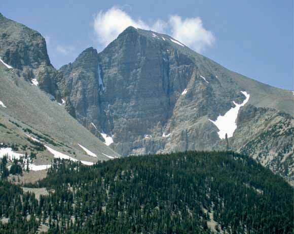
Wheeler Peak in the southern Snake Range (Great Basin National Park)
A geophysical investigation was undertaken as part of an effort to characterize the geologic framework influencing ground-water resources in east-central Nevada and west-central Utah. New gravity data were combined with existing aeromagnetic, drill-hole, and geologic data to help determine basin geometry, infer structural features, estimate depth to pre-Cenozoic basement rocks, and further constrain the horizontal extents of exposed and buried plutons. In addition, a three-dimensional (3D) geologic model was constructed to help illustrate the often complex geometries of individual basins and aid in assessing the connectivity of adjacent basins. In general, the thirteen major valleys within the study area have axes oriented north-south and frequently contain one or more sub-basins. These basins are often asymmetric and typically reach depths of 2 km. Analysis of gravity data helped delineate geophysical lineaments and accommodation zones. Structural complexities may further compartmentalize ground-water flow within basins and the influence of tectonics on basin sedimentation further complicates their hydrologic properties.
The horizontal extent of exposed and, in particular, buried plutons was estimated over the entire study area. The location and subsurface extents of these plutons will be very important for regional water resource assessments, as these features may act as either barriers or pathways for groundwater flow. A previously identified basement gravity low strikes NW within the study area and occurs within a highly extended terrane between the Butte and Confusion synclinoria. Evidence from geophysical, geologic, and seismic reflection data suggests relatively lower density plutonic rocks may extend to moderate crustal depths and rocks of similar composition may be the source of the entire basement gravity anomaly.
Download this report as a 47-page PDF file (of2007-1163.pdf; 10.3 MB).
Download Plate 1 as a ~18" x 24" PDF file (of2007-1163_plate1.pdf; 7.6 MB).
Download Plate 2 as a ~18" x 24" PDF file (of2007-1163_plate2.pdf; 6.8 MB).
For questions about the content of this report, contact Janet Watt
Download a free copy of the latest version of Adobe Reader.
|
Help |
PDF help |
Publications main page |
| Western Open-File Reports for 2007 |
| Geologic Division |
Geophysical Unit of Menlo Park, Calif. (GUMP)
|

![]() U.S. Department of the Interior | U.S. Geological Survey
U.S. Department of the Interior | U.S. Geological Survey
URL: https://pubs.usgs.gov/of/2007/1163/
Page Contact Information: Michael Diggles
Page Last Modified: January 9, 2008