
Open-File Report 2007-1191
![]() Title |
Introduction |
Setting |
Methods |
Results |
Discussion |
Data Catalog |
Acknowledgments |
References |
Figures |
Contacts
Title |
Introduction |
Setting |
Methods |
Results |
Discussion |
Data Catalog |
Acknowledgments |
References |
Figures |
Contacts
 |
||
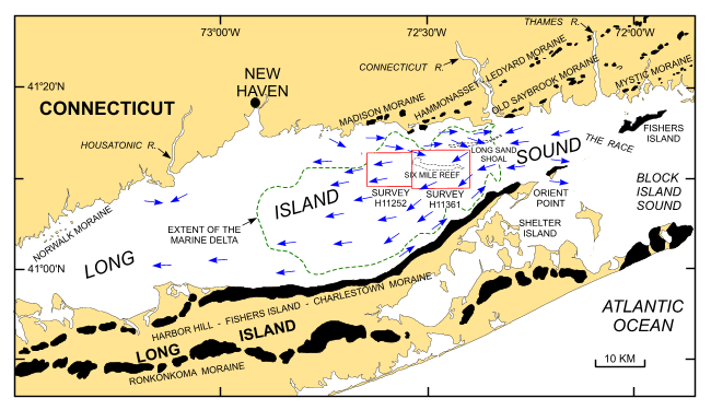
Figure 1. Map showing location of study area around Six Mile Reef (open red polygons). Also shown are major onshore moraines (solid black polygons), generalized net bottom sediment transport directions (blue arrows; Signell and others, 2000), and extent of the marine delta produced by the draining of glacial Lake Hitchcock (dashed green line; Lewis and Digiacomo-Cohen, 2000). | ||

![]() U.S. Department of the Interior |
U.S. Geological Survey
U.S. Department of the Interior |
U.S. Geological Survey
URL: http://pubsdata.usgs.gov/pubs/of/2007/1191/html/fig1.html
Page Contact Information: GS Pubs Web Contact
Page Last Modified: Wednesday, 04-Dec-2024 14:18:56 EST


