
Open-File Report 2007-1191
![]() Title |
Introduction |
Setting |
Methods |
Results |
Discussion |
Data Catalog |
Acknowledgments |
References |
Figures |
Contacts
Title |
Introduction |
Setting |
Methods |
Results |
Discussion |
Data Catalog |
Acknowledgments |
References |
Figures |
Contacts
 |
||
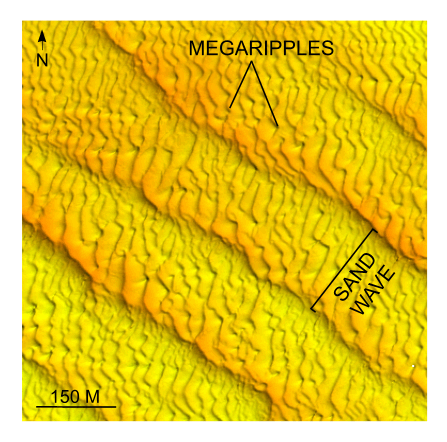
Figure 27. Detailed planar view of multibeam bathymetry from survey H11361 showing megaripples superimposed on transverse sand waves southwest of shoal. Wave symmetry suggests net southwesterly transport; megaripples on sand waves reveal a westerly transport component and suggest that transport is active. Location of detailed view is shown in figure 15. | ||

![]() U.S. Department of the Interior |
U.S. Geological Survey
U.S. Department of the Interior |
U.S. Geological Survey
URL: http://pubsdata.usgs.gov/pubs/of/2007/1191/html/fig27.html
Page Contact Information: GS Pubs Web Contact
Page Last Modified: Thursday, 05-Dec-2024 08:31:36 EST


